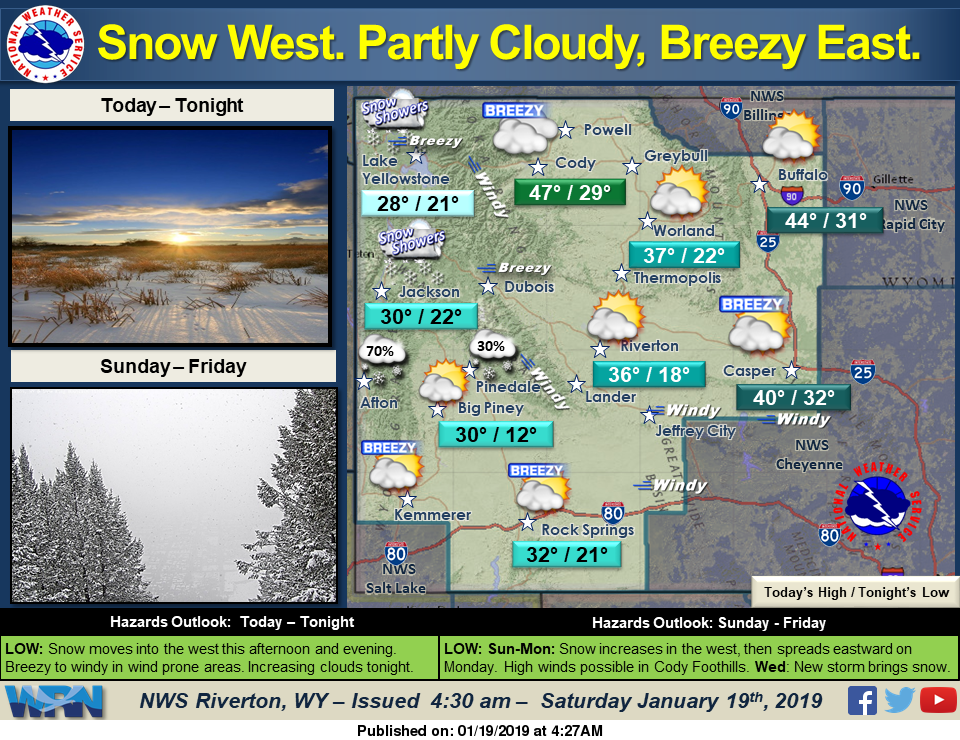

A front moving into western Wyoming today will bring snow showers to the west and northwest areas of the state. It will also enhance winds east of the Divide. Two additional systems will follow, one this evening and the next on Sunday night. The Sunday night system will be the most potent with moderate snow possible in the west, and light snow across the entire region.
Detailed Forecast
Today
Partly sunny, with a high near 35. Breezy, with a west southwest wind 14 to 22 mph, with gusts as high as 31 mph.
Tonight
Mostly cloudy, with a low around 21. Southwest wind 8 to 13 mph.
Sunday
Partly sunny, with a high near 37. Southwest wind 8 to 10 mph.
Sunday Night
Mostly cloudy, with a low around 18. South wind around 9 mph.
Monday
Snow, mainly after 11am. High near 30. Blustery, with a south wind 8 to 18 mph becoming north in the afternoon. Winds could gust as high as 26 mph. Chance of precipitation is 80%. New snow accumulation of 1 to 3 inches possible.
Monday Night
Snow likely, mainly before 11pm. Areas of blowing snow before 11pm. Mostly cloudy, with a low around 6. Blustery, with a north northeast wind 11 to 18 mph, with gusts as high as 25 mph. Chance of precipitation is 60%.
Tuesday
Mostly sunny, with a high near 22. Breezy, with a north northwest wind 9 to 15 mph becoming west in the morning. Winds could gust as high as 21 mph.
Tuesday Night
Partly cloudy, with a low around 9. Breezy.
Wednesday
A 20 percent chance of snow showers. Mostly cloudy, with a high near 28. Windy.
Wednesday Night
A 20 percent chance of snow showers before 11pm. Mostly cloudy, with a low around 12. Windy.
Thursday
Partly sunny, with a high near 28. Breezy.
Thursday Night
Partly cloudy, with a low around 11. Breezy.
Friday
Mostly sunny, with a high near 26. Breezy.