
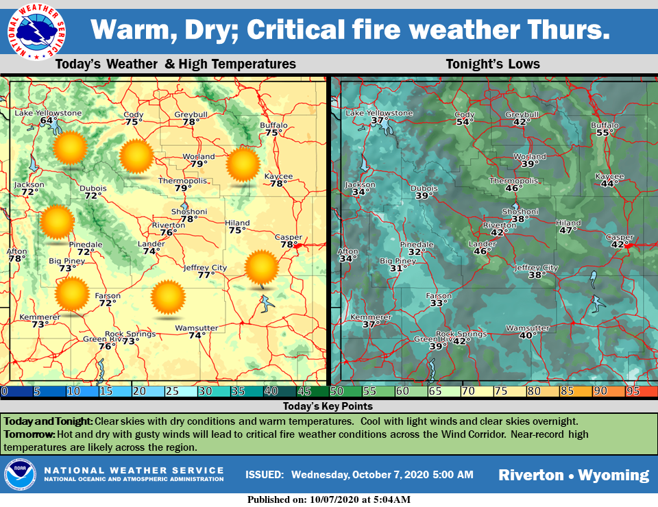
Weather Story
Continued warm, dry weather is expected across the region today. Critical fire weather conditions are expected across the Wind Corridor for tomorrow due to gusty winds in that area. Near-record high temperatures are expected tomorrow.
– Detailed Forecast –
Today
Sunny, with a high near 73. Calm wind becoming west 5 to 7 mph in the afternoon.
Tonight
Clear, with a low around 41. West southwest wind around 6 mph becoming light and variable.
Thursday
Sunny, with a high near 76. Light and variable wind becoming west 5 to 10 mph in the afternoon. Winds could gust as high as 21 mph.
Thursday Night
Partly cloudy, with a low around 38. Southwest wind 6 to 10 mph.
Friday
Mostly sunny, with a high near 70. West wind 5 to 10 mph.
Friday Night
Partly cloudy, with a low around 41. West wind 6 to 9 mph becoming south after midnight.
Saturday
Mostly sunny, with a high near 69. Breezy, with a southwest wind 6 to 15 mph, with gusts as high as 23 mph.
Saturday Night
A 20 percent chance of showers. Mostly cloudy, with a low around 40.
Sunday
A chance of rain showers before noon, then a chance of rain and snow showers. Mostly cloudy, with a high near 41. Breezy. Chance of precipitation is 50%.
Sunday Night
A slight chance of rain and snow showers before 9pm, then a slight chance of snow showers. Partly cloudy, with a low around 31. Blustery. Chance of precipitation is 20%.
Monday
Mostly sunny, with a high near 35. Breezy.
Monday Night
Partly cloudy, with a low around 33. Breezy.
Tuesday
Mostly sunny, with a high near 46. Breezy.
Whatever the weather, have a wonderful day!
From all of us here at SweetwaterNOW

