
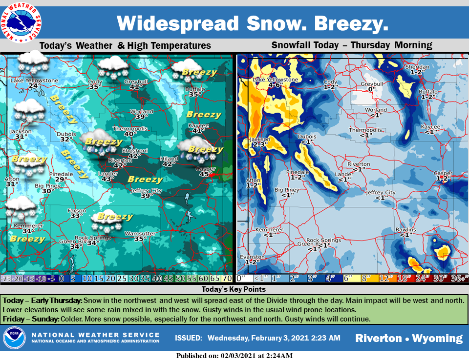
Weather Story
Snow in the northwest and west will spread east of the Divide through the day. There may be some rain mixed in at lower elevations. Winter Weather Advisories are in effect. Colder temperatures are expected for the end of the week.
– Detailed Forecast –
Today
Snow showers likely, mainly before 3pm. Mostly cloudy, with a high near 34. Breezy, with a west wind 13 to 23 mph, with gusts as high as 34 mph. Chance of precipitation is 60%. New snow accumulation of less than a half inch possible.
Tonight
Scattered snow showers before 8pm. Partly cloudy, with a low around 12. Wind chill values as low as -5. Breezy, with a west wind 14 to 18 mph, with gusts as high as 28 mph. Chance of precipitation is 30%.
Thursday
Mostly sunny, with a high near 27. Wind chill values as low as -5. Windy, with a west wind 16 to 21 mph increasing to 23 to 28 mph in the afternoon. Winds could gust as high as 40 mph.
Thursday Night
Mostly cloudy, with a low around 20. Breezy, with a west wind around 21 mph, with gusts as high as 29 mph.
Friday
A 20 percent chance of snow showers before 11am. Partly sunny, with a high near 32. Breezy, with a west wind 20 to 23 mph, with gusts as high as 33 mph.
Friday Night
Partly cloudy, with a low around 22. Breezy, with a west wind 18 to 22 mph.
Saturday
Mostly sunny, with a high near 32. Breezy.
Saturday Night
Mostly clear, with a low around 19. Breezy.
Sunday
Mostly sunny, with a high near 32. Breezy.
Sunday Night
Mostly clear, with a low around 16. Breezy.
Monday
Mostly sunny, with a high near 30. Breezy.
Monday Night
Partly cloudy, with a low around 14.
Tuesday
Mostly sunny, with a high near 28.
Whatever the weather, have a wonderful day!
From all of us here at SweetwaterNOW

