
Weather Story
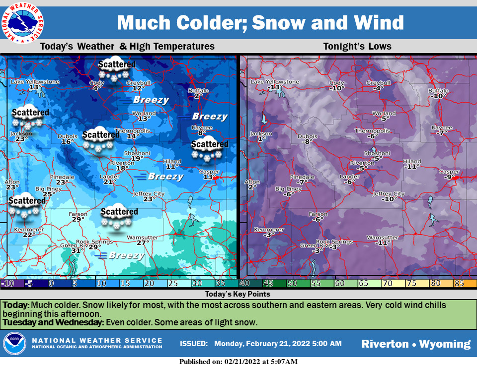
Much colder, with some snow likely for much of the area. Very cold wind chills are expected beginning this afternoon as wind increases. Tuesday and Wednesday will be even colder.
– Detailed Forecast –
Today
Snow showers, mainly after 9am. Patchy blowing snow after 4pm. High near 29. Blustery, with a west wind 9 to 18 mph becoming northeast in the afternoon. Winds could gust as high as 28 mph. Chance of precipitation is 80%. New snow accumulation of 2 to 4 inches possible.
Tonight
Snow showers likely, mainly before 1am. Patchy blowing snow. Cloudy, with a low around -3. Wind chill values as low as -25. Blustery, with an east northeast wind 18 to 23 mph, with gusts as high as 36 mph. Chance of precipitation is 70%. New snow accumulation of 1 to 2 inches possible.
Tuesday
Snow showers likely, mainly before 1am. Patchy blowing snow. Cloudy, with a low around -3. Wind chill values as low as -25. Blustery, with an east northeast wind 18 to 23 mph, with gusts as high as 36 mph. Chance of precipitation is 70%. New snow accumulation of 1 to 2 inches possible.
Tuesday Night
A 20 percent chance of snow showers after 11pm. Mostly cloudy, with a low around -7. Blustery, with an east northeast wind 14 to 16 mph, with gusts as high as 21 mph.
Wednesday
A 20 percent chance of snow showers before 11am. Mostly cloudy, with a high near 12. Blustery, with an east northeast wind 13 to 16 mph, with gusts as high as 25 mph.
Wednesday Night
Partly cloudy, with a low around -9. East wind 7 to 9 mph becoming west southwest after midnight.
Thursday
Mostly sunny, with a high near 20. Breezy.
Thursday Night
Mostly cloudy, with a low around 2.
Friday
Partly sunny, with a high near 24.
Friday Night
Mostly clear, with a low around -2.
Saturday
Sunny, with a high near 29. Breezy.
Saturday Night
Mostly clear, with a low around 3. Breezy.
Sunday
Sunny, with a high near 35. Breezy.
Whatever the weather, have a wonderful day!
From all of us here at SweetwaterNOW

