
Weather Story
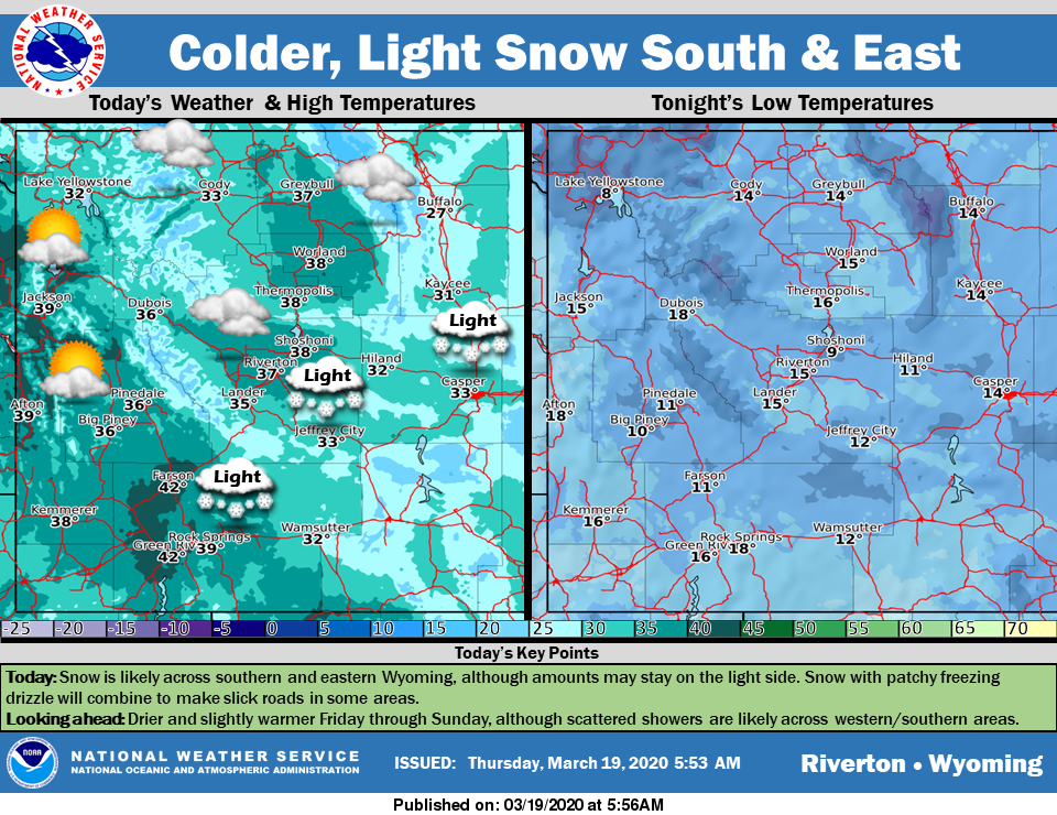
Snow is likely across southern and eastern Wyoming, although amounts may stay on the lighter side. Snow and patchy freezing drizzle will combine to make slick roads in some areas.
– Detailed Forecast –
Today
A chance of snow before 1pm, then a chance of rain and snow. Cloudy, with a high near 40. Breezy, with a north northwest wind 8 to 17 mph becoming east in the afternoon. Winds could gust as high as 24 mph. Chance of precipitation is 50%. New snow accumulation of less than a half inch possible.
Tonight
A 40 percent chance of snow, mainly before midnight. Mostly cloudy, with a low around 18. Breezy, with an east wind 8 to 15 mph, with gusts as high as 21 mph. New snow accumulation of less than a half inch possible.
Friday
A 20 percent chance of snow after noon. Mostly cloudy, with a high near 40. East wind 5 to 10 mph becoming west in the afternoon.
Friday Night
Partly cloudy, with a low around 23. Southwest wind 8 to 10 mph.
Saturday
Mostly sunny, with a high near 44. West southwest wind 8 to 14 mph, with gusts as high as 20 mph.
Saturday Night
Mostly clear, with a low around 24. West southwest wind 9 to 14 mph, with gusts as high as 20 mph.
Sunday
Mostly sunny, with a high near 49. Breezy.
Sunday Night
Partly cloudy, with a low around 23. Breezy.
Monday
Partly sunny, with a high near 49.
Monday Night
A slight chance of rain and snow. Mostly cloudy, with a low around 28.
Tuesday
A chance of rain and snow. Mostly cloudy, with a high near 46.
Tuesday Night
A chance of snow. Mostly cloudy, with a low around 28.
Wednesday
A chance of snow. Mostly cloudy, with a high near 43.
Whatever the weather, have a wonderful day!
From all of us here at SweetwaterNOW

