
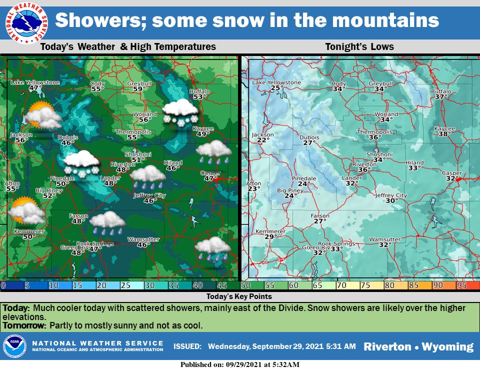
Weather Story
Much cooler weather is expected for today. Some rain showers are likely, mainly in areas east of the Divide. The Bighorns and Wind River Range may see some minor snow accumulations. Cold tonight. More sunshine tomorrow and not as cool as today.
– Detailed Forecast –
Today
Showers likely, mainly before 9am. Cloudy, with a high near 47. West southwest wind 6 to 11 mph becoming east northeast in the afternoon. Chance of precipitation is 70%. New precipitation amounts between a tenth and quarter of an inch possible.
Tonight
A 40 percent chance of showers, mainly before 9pm. Patchy fog after 4am. Otherwise, mostly cloudy, with a low around 33. Northeast wind 5 to 10 mph.
Thursday
Patchy fog before 9am. Otherwise, mostly sunny, with a high near 55. Northeast wind 5 to 8 mph.
Thursday Night
Mostly clear, with a low around 33. East northeast wind 5 to 9 mph becoming light and variable.
Friday
Sunny, with a high near 62. Calm wind becoming northwest 5 to 8 mph in the afternoon.
Friday Night
Mostly clear, with a low around 36. Northwest wind 5 to 8 mph becoming light and variable.
Saturday
Mostly sunny, with a high near 63.
Saturday Night
Mostly clear, with a low around 37.
Sunday
Sunny, with a high near 66.
Sunday Night
Mostly clear, with a low around 36.
Monday
Sunny, with a high near 69.
Monday Night
Mostly clear, with a low around 37.
Tuesday
Mostly sunny, with a high near 70.
Whatever the weather, have a wonderful day!
From all of us here at SweetwaterNOW

