
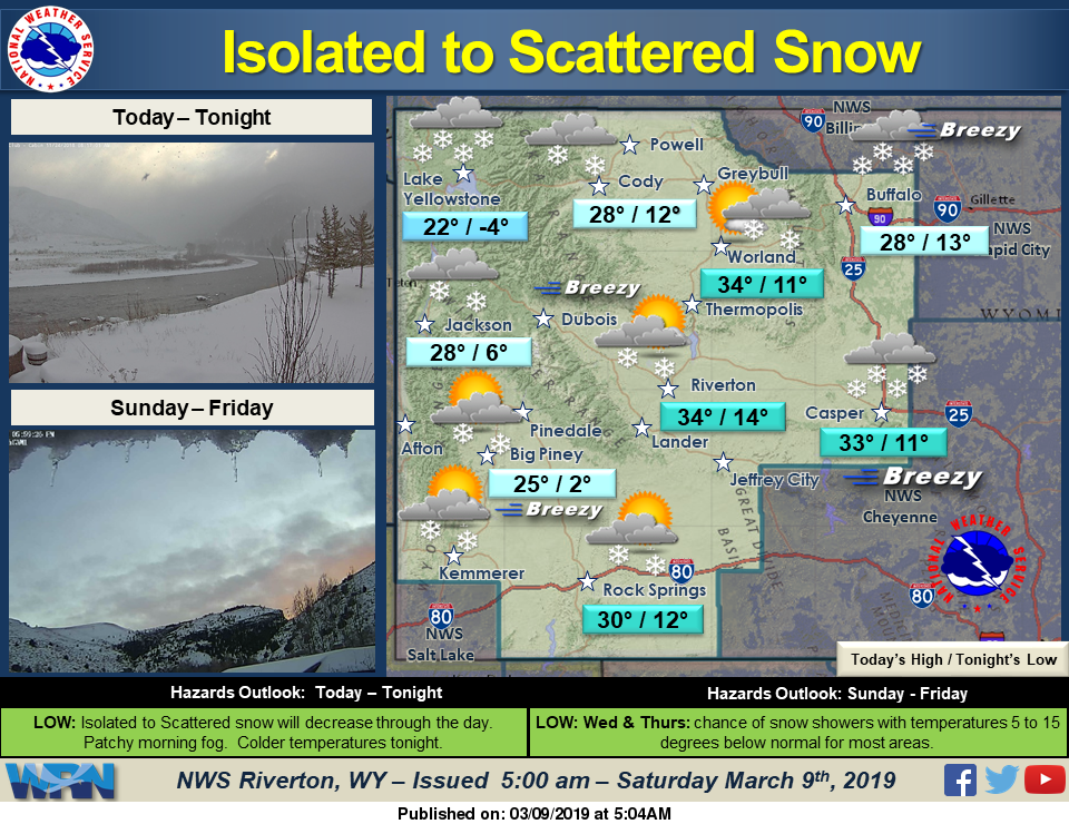
Scattered snow showers will continue across the state through the morning, then become more isolated. Snow will taper off by this evening. Otherwise, expect some patchy morning fog and partly cloudy skies. Sunday will be slightly warmer & mostly dry with clearing skies.
Detailed Forecast
Today
Isolated snow showers after 4pm. Increasing clouds, with a high near 30. Wind chill values as low as zero. Breezy, with a west southwest wind 7 to 15 mph, with gusts as high as 20 mph. Chance of precipitation is 20%.
Tonight
Mostly cloudy, with a low around 13. Calm wind becoming east northeast around 5 mph after midnight.
Sunday
A slight chance of snow showers between 10am and 11am. Partly sunny, with a high near 33. Northeast wind around 6 mph. Chance of precipitation is 20%.
Sunday Night
Mostly cloudy, with a low around 20. East northeast wind around 7 mph.
Monday
Mostly cloudy, with a high near 34. East northeast wind around 5 mph becoming calm.
Monday Night
Mostly cloudy, with a low around 21. Southwest wind 5 to 7 mph.
Tuesday
Partly sunny, with a high near 36. West southwest wind around 5 mph.
Tuesday Night
Partly cloudy, with a low around 18.
Wednesday
A chance of flurries before 11am, then a chance of snow showers after 11am. Mostly cloudy, with a high near 33. Chance of precipitation is 30%.
Wednesday Night
A 20 percent chance of snow showers. Mostly cloudy, with a low around 15.
Thursday
A slight chance of snow showers. Cloudy, with a high near 28.
Thursday Night
Mostly cloudy, with a low around 10.
Friday
Mostly sunny, with a high near 29.

