
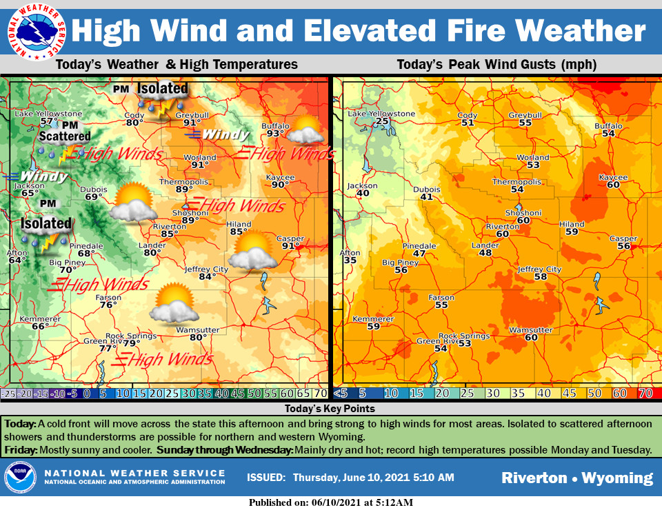
Weather Story
A cold front will bring high wind and elevated fire weather for most areas today. A few showers and t-storms are possible in northern and western Wyoming. After a mild day Friday, hot weather will return Sunday into next week.
– Detailed Forecast –
Today
Increasing clouds, with a high near 79. Windy, with a south southeast wind 10 to 20 mph becoming west southwest 24 to 34 mph. Winds could gust as high as 50 mph.
Tonight
Mostly clear, with a low around 36. Windy, with a west wind 24 to 34 mph decreasing to 8 to 18 mph. Winds could gust as high as 50 mph.
Friday
Sunny, with a high near 75. West southwest wind 5 to 10 mph.
Friday Night
Mostly clear, with a low around 46. West wind 5 to 8 mph becoming calm after midnight.
Saturday
Sunny, with a high near 86. Light and variable wind becoming west southwest 5 to 7 mph in the morning.
Saturday Night
Clear, with a low around 52. West wind 5 to 7 mph becoming light and variable after midnight.
Sunday
Sunny, with a high near 92. Light southeast wind becoming south 6 to 11 mph in the morning.
Sunday Night
Mostly clear, with a low around 54.
Monday
Sunny, with a high near 95.
Monday Night
Mostly clear, with a low around 56
Tuesday
Sunny, with a high near 94.
Tuesday Night
Mostly clear, with a low around 58.
Wednesday
Sunny, with a high near 95.
Whatever the weather, have a wonderful day!
From all of us here at SweetwaterNOW

