
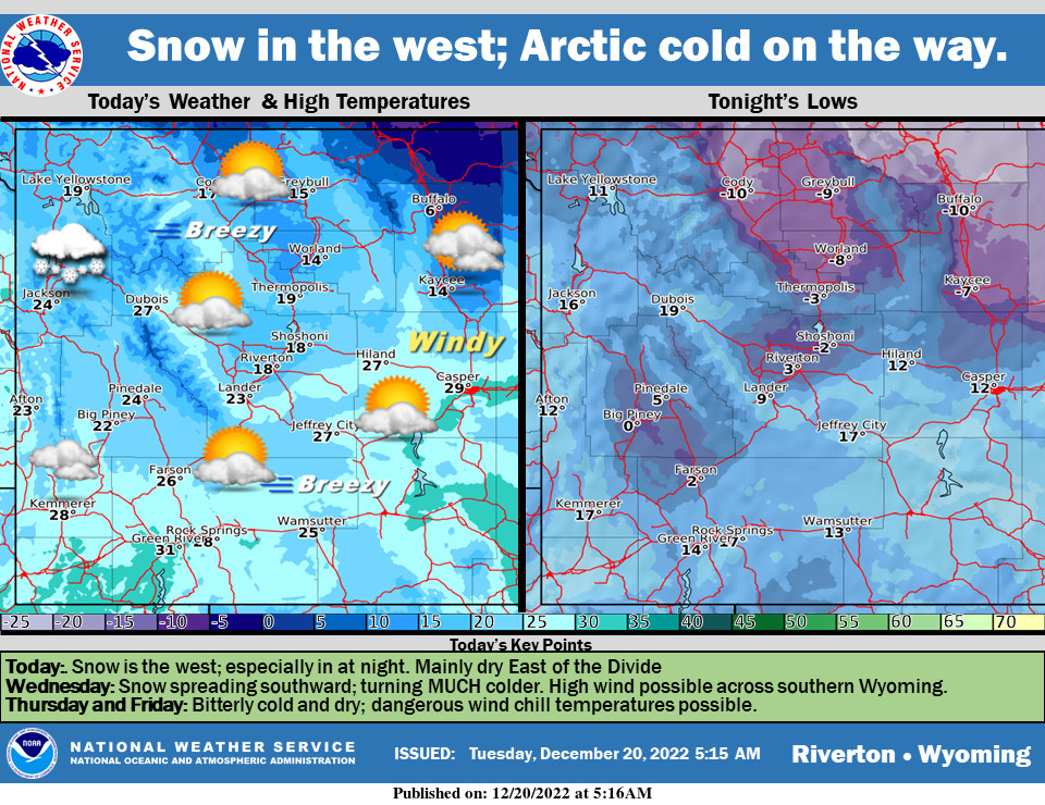
Weather Story
Occasional snow across the west will become steadier and heavier tonight. Mainly dry East of the Divide with breezy to windy conditions in the favored locations. Snow across the area tomorrow with bitterly cold temperatures Wednesday through Friday.
– Detailed Forecast –
Today
Patchy blowing snow between 1pm and 2pm. Mostly cloudy, with a high near 29. Wind chill values as low as -5. Breezy, with a west southwest wind 13 to 17 mph, with gusts as high as 26 mph.
Tonight
Mostly cloudy, with a low around 14. Wind chill values as low as zero. Breezy, with a west southwest wind 11 to 15 mph, with gusts as high as 23 mph.
Wednesday
Snow likely, mainly after 11am. Partly sunny, with a high near 32. Wind chill values as low as -5. Windy, with a southwest wind 15 to 20 mph increasing to 27 to 32 mph in the afternoon. Winds could gust as high as 48 mph. Chance of precipitation is 60%. New snow accumulation of less than one inch possible.
Wednesday Night
A 30 percent chance of snow, mainly before 11pm. Mostly cloudy, with a low around -19. Wind chill values as low as -40. Blustery, with a west northwest wind 18 to 23 mph becoming northeast 10 to 15 mph after midnight. Winds could gust as high as 34 mph.
Thursday
Mostly sunny and cold, with a high near -8. East northeast wind 8 to 10 mph.
Thursday Night
Mostly cloudy, with a low around -18. South southeast wind around 6 mph becoming southwest after midnight.
Friday
Mostly cloudy, with a high near 14. West wind 6 to 11 mph.
Friday Night
Mostly cloudy, with a low around 5.
Saturday
Partly sunny, with a high near 28. Breezy.
Saturday Night
Mostly cloudy, with a low around 21. Breezy.
Christmas Day
Mostly cloudy, with a high near 31. Breezy.
Sunday Night
Mostly cloudy, with a low around 19. Breezy.
Monday
Partly sunny, with a high near 35. Breezy.
Whatever the weather, have a wonderful day!
From all of us here at SweetwaterNOW

