
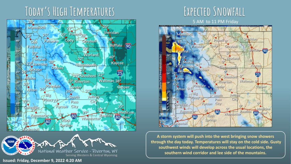
Weather Story
Increasing clouds across the area today as a new storm system approaches. The west will see light snow starting this morning and lasting most of the day. Windy conditions will develop for the usual wind prone areas.
– Detailed Forecast –
Today
Isolated snow showers after 2pm. Mostly cloudy, with a high near 30. Wind chill values as low as -5. Breezy, with a north wind 5 to 10 mph becoming west southwest 17 to 22 mph in the morning. Winds could gust as high as 33 mph. Chance of precipitation is 20%.
Tonight
Partly cloudy, with a low around 7. Wind chill values as low as zero. Breezy, with a west southwest wind 12 to 17 mph becoming south southeast 6 to 11 mph after midnight. Winds could gust as high as 26 mph.
Saturday
Partly sunny, with a high near 28. Wind chill values as low as zero. East wind 5 to 8 mph becoming south in the morning.
Saturday Night
Mostly cloudy, with a low around 14. South wind around 9 mph.
Sunday
Isolated snow showers after 11am. Partly sunny, with a high near 33. Breezy, with a south wind 9 to 16 mph, with gusts as high as 24 mph. Chance of precipitation is 20%
Sunday Night
Scattered snow showers, mainly after 11pm. Mostly cloudy, with a low around 19. South southeast wind 8 to 13 mph. Chance of precipitation is 30%.
Monday
Scattered snow showers. Cloudy, with a high near 28. South wind 7 to 10 mph becoming west in the afternoon. Chance of precipitation is 50%.
Monday Night
Scattered snow showers. Mostly cloudy, with a low around 12. Chance of precipitation is 50%.
Tuesday
Scattered snow showers, mainly before 11am. Cloudy, with a high near 20. Chance of precipitation is 30%.
Tuesday Night
Mostly cloudy, with a low around 6.
Wednesday
Partly sunny, with a high near 15.
Wednesday Night
Mostly cloudy, with a low around 4.
Thursday
Partly sunny, with a high near 13.
Whatever the weather, have a wonderful day!
From all of us here at SweetwaterNOW

