
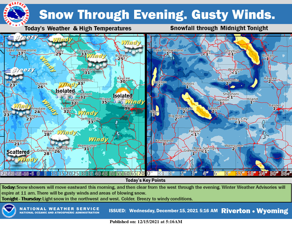
Weather Story
Snow showers will move eastward through this morning, and then clear from the west through the evening. Winter Weather Advisories for the west will expire at 11 am. The northwest and west will see more snow Thursday. Temperatures will be much colder behind the front. Gusty winds will continue.
– Detailed Forecast –
Today
Snow likely, mainly before 10am. Cloudy through mid morning, then gradual clearing, with a temperature falling to around 21 by 10am. Windy, with a west wind 26 to 31 mph, with gusts as high as 40 mph. Chance of precipitation is 60%. New snow accumulation of less than one inch possible.
Tonight
A 10 percent chance of snow after 5am. Mostly cloudy, then gradually becoming mostly clear, with a low around 13. Breezy, with a west southwest wind 8 to 17 mph becoming east northeast after midnight. Winds could gust as high as 25 mph.
Thursday
A 30 percent chance of snow, mainly before noon. Mostly cloudy, with a high near 32. Breezy, with a northwest wind 8 to 17 mph becoming south southwest in the morning. Winds could gust as high as 24 mph.
Thursday Night
Partly cloudy, with a low around 15. Breezy, with a west southwest wind around 15 mph, with gusts as high as 20 mph.
Friday
Mostly sunny, with a high near 26. Breezy, with a west wind 16 to 22 mph, with gusts as high as 31 mph.
Friday Night
Mostly clear, with a low around 4. Breezy, with a southwest wind 9 to 16 mph, with gusts as high as 21 mph.
Saturday
Mostly sunny, with a high near 24.
Saturday Night
Partly cloudy, with a low around 9.
Sunday
Mostly sunny, with a high near 31.
Sunday Night
Partly cloudy, with a low around 10.
Monday
Mostly sunny, with a high near 30.
Monday Night
Partly cloudy, with a low around 13.
Tuesday
Mostly sunny, with a high near 32.
Whatever the weather, have a wonderful day!
From all of us here at SweetwaterNOW

