
Weather Story
A warm start to the weekend. Isolated thunderstorms will be possible; especially in the south and west but most places will not see one. Sunday will be hot and dry before the chance of storms returns early next week.
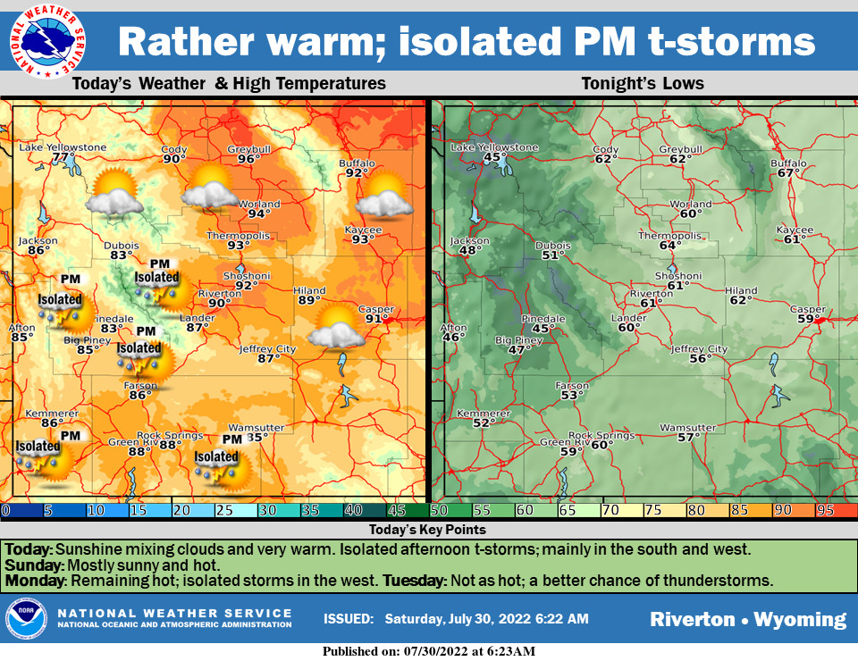
– Detailed Forecast –
Today
Isolated showers and thunderstorms between 2pm and 4pm. Some of the storms could produce gusty winds. Sunny, with a high near 89. South southwest wind 7 to 11 mph becoming northwest in the afternoon. Chance of precipitation is 20%.
Tonight
Partly cloudy, with a low around 58. North northwest wind 5 to 11 mph becoming south after midnight.
Sunday
Sunny, with a high near 90. South southwest wind 5 to 11 mph becoming west northwest in the morning.
Sunday Night
Partly cloudy, with a low around 59. West wind 6 to 10 mph becoming south southwest in the evening.
Monday
Mostly sunny, with a high near 88. West southwest wind 6 to 13 mph, with gusts as high as 20 mph.
Monday Night
Isolated showers and thunderstorms before midnight. Mostly cloudy, with a low around 59. Southwest wind 6 to 14 mph, with gusts as high as 21 mph. Chance of precipitation is 20%.
Tuesday
A 50 percent chance of showers and thunderstorms after noon. Partly sunny, with a high near 80. Windy, with a west wind 8 to 13 mph increasing to 21 to 26 mph in the afternoon. Winds could gust as high as 39 mph.
Tuesday Night
A 20 percent chance of showers and thunderstorms before midnight. Mostly cloudy, with a low around 57. Breezy.
Wednesday
A 20 percent chance of showers and thunderstorms after noon. Mostly sunny, with a high near 81. Breezy.
Wednesday Night
Mostly clear, with a low around 56. Breezy.
Thursday
Sunny, with a high near 85. Breezy
Thursday Night
Partly cloudy, with a low around 58.
Friday
A slight chance of showers and thunderstorms. Mostly sunny, with a high near 86. Breezy.
Whatever the weather, have a wonderful day!
From all of us here at SweetwaterNOW

