
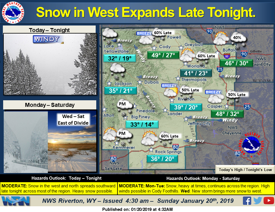
Snow continues in the west and north today and will spread across the entire region beginning late tonight, early Monday. Heavy snow is possible in the mountains and far western valleys. Gusty to strong winds will be associated with this front, with high winds possible in the Cody Foothills on Monday. A Winter Storm Watch has been issued.
Detailed Forecast
Today
Partly sunny, with a high near 38. South southwest wind 9 to 13 mph.
Tonight
A 20 percent chance of snow after 2am. Mostly cloudy, with a low around 19. South southwest wind 7 to 10 mph
Monday
Snow, mainly after 11am. Areas of blowing snow. High near 31. Blustery, with a south wind 6 to 11 mph becoming north northeast 17 to 22 mph in the afternoon. Winds could gust as high as 33 mph. Chance of precipitation is 80%. New snow accumulation of 2 to 4 inches possible.
Monday Night
A 50 percent chance of snow, mainly before 11pm. Areas of blowing snow before 11pm. Cloudy, with a low around 6. Wind chill values as low as -10. Blustery, with a north northeast wind 17 to 22 mph decreasing to 9 to 14 mph after midnight. Winds could gust as high as 33 mph. New snow accumulation of less than a half inch possible.
Tuesday
Mostly sunny, with a high near 19. Breezy, with a west wind 6 to 15 mph, with gusts as high as 22 mph.
Tuesday Night
Partly cloudy, with a low around 6. Breezy, with a west wind around 17 mph, with gusts as high as 26 mph
Wednesday
Mostly cloudy, with a high near 28. Breezy, with a west wind 18 to 24 mph, with gusts as high as 32 mph.
Wednesday Night
A 20 percent chance of snow showers. Mostly cloudy, with a low around 13. Breezy.
Thursday
Mostly cloudy, with a high near 28. Breezy.
Thursday Night
Partly cloudy, with a low around 10. Breezy.
Friday
Mostly sunny, with a high near 28. Breezy.
Friday Night
Mostly cloudy, with a low around 10. Breezy.
Saturday
Sunny, with a high near 29.

