
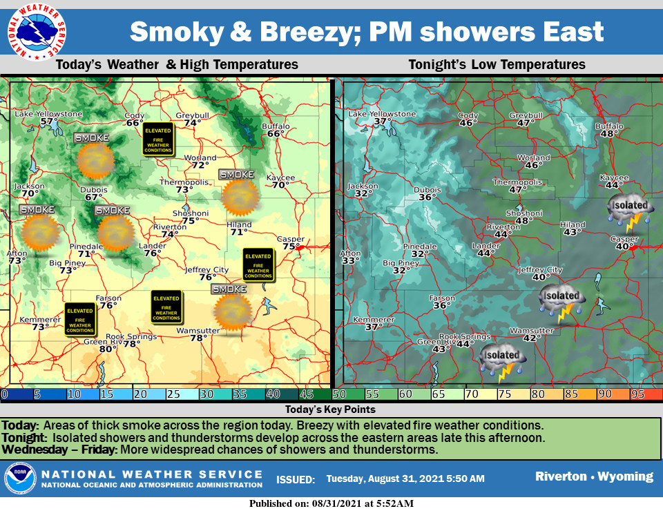
Weather Story
Warm, dry, and very smoky today. Showers and thunderstorms will begin to develop across eastern areas this afternoon. Chances of showers and thunderstorms continue and become more widespread through the rest of the week.
– Detailed Forecast –
Today
Patchy smoke. Increasing clouds, with a high near 83. Breezy, with a light and variable wind becoming west northwest 12 to 17 mph in the morning. Winds could gust as high as 23 mph.
Tonight
A 40 percent chance of showers, mainly between 2am and 5am. Areas of smoke. Cloudy, with a low around 56. Breezy, with a west northwest wind 9 to 17 mph becoming east southeast after midnight. Winds could gust as high as 23 mph.
Wednesday
A chance of showers, with thunderstorms also possible after noon. Cloudy, with a high near 74. Breezy, with a northeast wind 11 to 21 mph becoming south southwest in the morning. Winds could gust as high as 26 mph. Chance of precipitation is 30%.
Wednesday Night
Mostly cloudy, with a low around 51. Breezy, with a northwest wind 13 to 18 mph becoming south southwest 5 to 10 mph in the evening. Winds could gust as high as 24 mph.
Thursday
Sunny, with a high near 77. West wind 5 to 14 mph, with gusts as high as 20 mph.
Thursday Night
Partly cloudy, with a low around 49. Southwest wind 5 to 13 mph becoming south southeast after midnight.
Friday
A 20 percent chance of showers and thunderstorms after noon. Sunny, with a high near 77. Breezy, with a south southeast wind 5 to 15 mph becoming west in the afternoon. Winds could gust as high as 21 mph.
Friday Night
Mostly clear, with a low around 47.
Saturday
Sunny, with a high near 78.
Saturday Night
Mostly clear, with a low around 48.
Sunday
Sunny, with a high near 80.
Sunday Night
Partly cloudy, with a low around 50.
Labor Day
Mostly sunny, with a high near 80.
Whatever the weather, have a wonderful day!
From all of us here at SweetwaterNOW

