
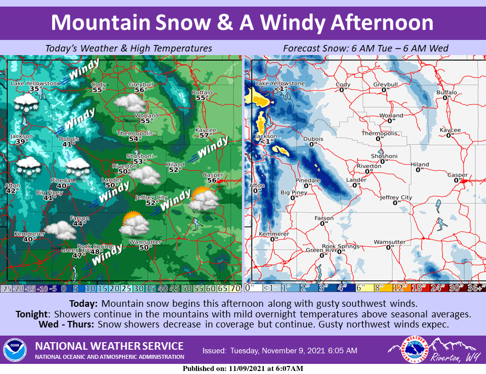
Weather Story
Mountain snow begins in the west this afternoon accompanied by gusty southwest winds area-wide. Showers continue in the mountains tonight with mild overnight temperatures above seasonal averages. Snow showers decrease in coverage Wednesday afternoon but remain possible in the mountains. Winds shift to northwesterly Wednesday, and will be gusty during the afternoon both Wednesday and Thursday.
– Detailed Forecast –
Today
Rain likely, mainly after 5pm. Mostly cloudy, with a high near 48. Breezy, with a light and variable wind becoming west 10 to 15 mph in the morning. Winds could gust as high as 24 mph. Chance of precipitation is 60%.
Tonight
A chance of rain, possibly mixing with snow after 1am, then gradually ending. Cloudy, then gradually becoming partly cloudy, with a low around 32. Breezy, with a southwest wind 14 to 18 mph becoming south southeast after midnight. Winds could gust as high as 30 mph. Chance of precipitation is 50%. Little or no snow accumulation expected.
Wednesday
Mostly sunny, with a high near 40. Windy, with a south southwest wind 14 to 19 mph becoming west 21 to 26 mph in the morning. Winds could gust as high as 44 mph.
Wednesday Night
Partly cloudy, with a low around 28. Breezy, with a west wind 14 to 16 mph, with gusts as high as 30 mph.
Thursday
Partly sunny, with a high near 44. Windy, with a west wind 21 to 29 mph, with gusts as high as 40 mph.
Thursday Night
Mostly cloudy, with a low around 32. Breezy, with a west wind 14 to 21 mph, with gusts as high as 28 mph.
Friday
Partly sunny, with a high near 50. Breezy.
Friday Night
Mostly cloudy, with a low around 35. Breezy.
Saturday
Partly sunny, with a high near 54. Breezy.
Saturday Night
Mostly cloudy, with a low around 33. Breezy.
Sunday
Partly sunny, with a high near 52. Breezy.
Sunday Night
Mostly cloudy, with a low around 31.
Monday
Partly sunny, with a high near 53.
Whatever the weather, have a wonderful day!
From all of us here at SweetwaterNOW

