
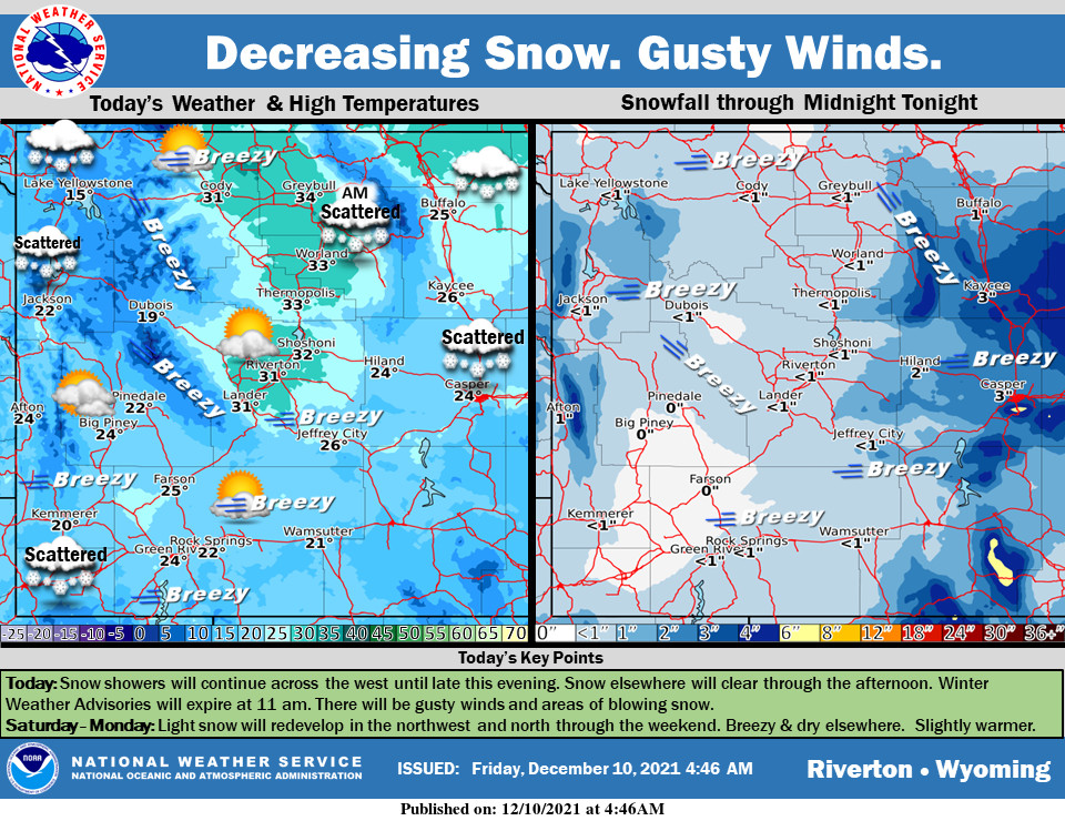
Weather Story
Scattered snow showers in the west. In areas East of the Divide, it will be mild. Strong winds will blow in the Lee of the Absarokas and from the Green Mountains through Natrona County. Steadier snow will move into the west tonight
– Detailed Forecast –
Today
Snow showers in the west will continue through late this evening. For areas east of the Divide the Winter Weather Advisories will expire at 11 am and snow will clear. Gusty winds will create areas of blowing snow and reduced visibility. The northwest and west will see more snow over the weekend. There will be slightly warmer temperatures this weekend.
Tonight
Partly cloudy, with a low around 8. Wind chill values as low as -10. Breezy, with a west southwest wind 16 to 18 mph, with gusts as high as 29 mph.
Saturday
Patchy blowing snow between 1pm and 4pm. Mostly sunny, with a high near 27. Wind chill values as low as -10. Breezy, with a west southwest wind 14 to 18 mph, with gusts as high as 28 mph.
Saturday Night
Partly cloudy, with a low around 11. Wind chill values as low as zero. South wind 8 to 10 mph.
Sunday
Mostly sunny, with a high near 34. South wind 9 to 13 mph.
Sunday Night
Mostly cloudy, with a low around 19. South wind 8 to 11 mph.
Monday
Mostly sunny, with a high near 37. South wind 9 to 13 mph.
Monday Night
Partly cloudy, with a low around 26.
Tuesday
Mostly sunny, with a high near 42. Breezy.
Tuesday Night
Snow showers likely before 10pm, then rain and snow showers likely between 10pm and 1am, then snow showers likely after 1am. Mostly cloudy, with a low around 25. Breezy. Chance of precipitation is 70%.
Wednesday
A chance of snow showers. Partly sunny, with a high near 35. Windy
Wednesday Night
Partly cloudy, with a low around 13. Breezy.
Thursday
Mostly sunny, with a high near 31.
Whatever the weather, have a wonderful day!
From all of us here at SweetwaterNOW

