
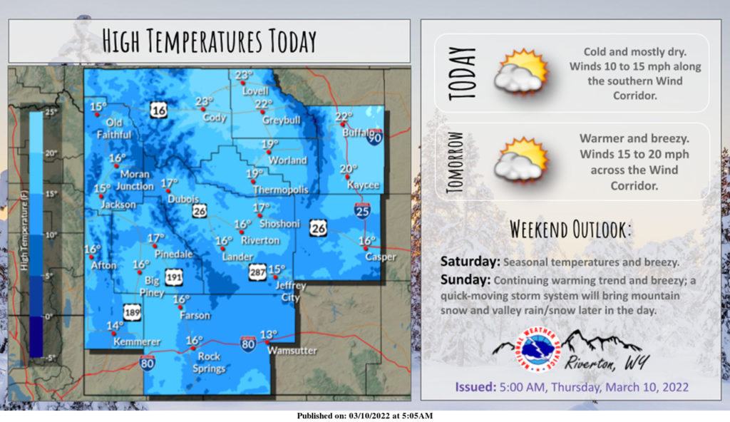
Weather Story
Somewhat warmer today. Mostly dry except this morning across the far northwest, where some isolated snow showers are possible. Much warmer temperatures and the Wyoming wind return by the weekend with chances for mountain snow and valley rain Sunday afternoon.
– Detailed Forecast –
Today
Patchy blowing snow after noon. Sunny, with a high near 28. Wind chill values as low as -20. Breezy, with a west wind 10 to 15 mph increasing to 16 to 21 mph in the afternoon. Winds could gust as high as 29 mph.
Tonight
Patchy blowing snow before 10pm. Mostly clear, with a low around 13. Wind chill values as low as zero. Breezy, with a west wind 14 to 20 mph, with gusts as high as 28 mph.
Saturday
Sunny, with a high near 40. Wind chill values as low as zero. Breezy, with a west wind 13 to 17 mph, with gusts as high as 24 mph.
Saturday Night
Mostly clear, with a low around 22. South southwest wind 6 to 11 mph.
Sunday
A 20 percent chance of snow showers after noon. Partly sunny, with a high near 42. Breezy, with a south southwest wind 7 to 12 mph increasing to 18 to 23 mph in the afternoon. Winds could gust as high as 34 mph.
Sunday Night
Partly cloudy, with a low around 21. Breezy, with a west wind 14 to 21 mph, with gusts as high as 31 mph.
Monday
Sunny, with a high near 41. Breezy, with a west wind 10 to 20 mph, with gusts as high as 29 mph.
Monday Night
Partly cloudy, with a low around 23.
Tuesday
Mostly sunny, with a high near 48.
Tuesday Night
A 20 percent chance of snow showers after midnight. Mostly cloudy, with a low around 27. Breezy.
Wednesday
A slight chance of snow showers. Partly sunny, with a high near 44. Breezy.
Wednesday Night
Partly cloudy, with a low around 21. Breezy.
Thursday
Mostly sunny, with a high near 44. Breezy.
Whatever the weather, have a wonderful day!
From all of us here at SweetwaterNOW

