
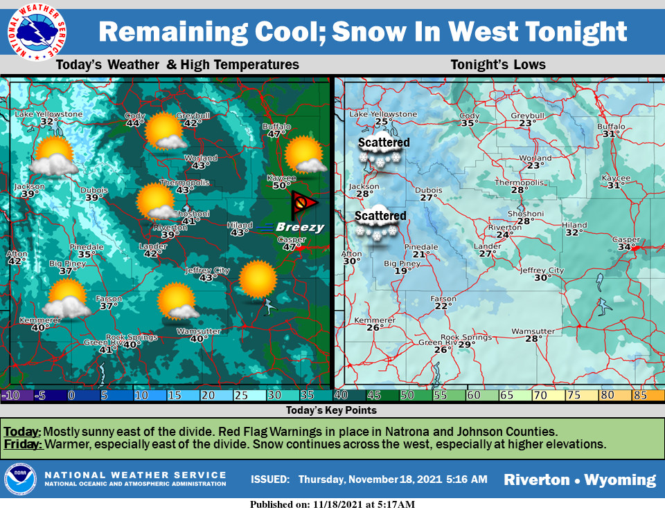
Weather Story
Dry and breezy conditions in Natrona and Eastern Johnson Counties will cause an elevated fire risk today. It remains cool with increasing clouds throughout the day. Snow moves into western areas tonight with accumulating snow likely at higher elevations. A warmup is on the way for Friday.
– Detailed Forecast –
Today
Increasing clouds, with a high near 40. Calm wind becoming west southwest 5 to 7 mph in the afternoon.
Tonight
Mostly cloudy, with a low around 27. Southwest wind 5 to 9 mph.
Friday
Partly sunny, with a high near 48. Southwest wind 8 to 14 mph, with gusts as high as 20 mph.
Friday Night
Mostly cloudy, with a low around 27. West wind 9 to 14 mph, with gusts as high as 21 mph.
Saturday
Mostly sunny, with a high near 41. Breezy, with a west wind 11 to 18 mph, with gusts as high as 28 mph
Saturday Night
Mostly clear, with a low around 17. Breezy, with a west wind 10 to 15 mph, with gusts as high as 23 mph.
Sunday
Sunny, with a high near 41. Breezy, with a west wind 10 to 16 mph, with gusts as high as 24 mph.
Sunday Night
Mostly clear, with a low around 18.
Monday
Sunny, with a high near 49.
Monday Night
Partly cloudy, with a low around 20.
Tuesday
Partly sunny, with a high near 46. Breezy.
Tuesday Night
Mostly cloudy, with a low around 18.
Wednesday
Mostly sunny, with a high near 37. Breezy.
Whatever the weather, have a wonderful day!
From all of us here at SweetwaterNOW

