
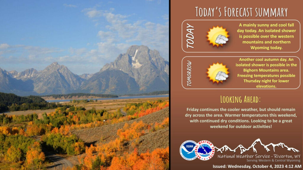
Weather Story
More sun today, with cool fall temperatures. A shower is possible over far western Wyoming today, with a small chance for showers over northern Wyoming into this evening. A transition to drier and warmer weather this weekend.
– Detailed Forecast –
Today
Patchy fog after 4am. Patchy frost after 5am. Otherwise, mostly clear, with a low around 36. Breezy, with a southwest wind 12 to 17 mph decreasing to 6 to 11 mph after midnight. Winds could gust as high as 25 mph.
Tonight
Patchy fog before 9am. Patchy frost before 8am. Otherwise, sunny, with a high near 62. West wind 6 to 13 mph.
Thursday
Mostly sunny, with a high near 58. Breezy, with a west wind 7 to 12 mph increasing to 13 to 18 mph in the afternoon. Winds could gust as high as 25 mph.
Thursday Night
Patchy fog after 5am. Widespread frost, mainly after 4am. Otherwise, mostly clear, with a low around 33. West wind 5 to 11 mph becoming east northeast after midnight.
Friday
Patchy fog before 7am. Widespread frost before 9am. Otherwise, sunny, with a high near 58. East wind 6 to 10 mph.
Friday Night
Widespread frost, mainly after 4am. Otherwise, mostly clear, with a low around 33. East northeast wind 5 to 8 mph becoming light and variable.
Saturday
Widespread frost, mainly before 7am. Otherwise, sunny, with a high near 67. South southeast wind 5 to 10 mph becoming west in the afternoon.
Saturday Night
Clear, with a low around 36.
Sunday
Areas of frost before 7am. Otherwise, sunny, with a high near 69.
Sunday Night
Areas of frost after 5am. Otherwise, mostly clear, with a low around 36.
Monday
Areas of frost. Otherwise, sunny, with a high near 69.
Monday Night
Mostly clear, with a low around 37.
Tuesday
Mostly sunny, with a high near 68.
Whatever the weather, have a wonderful day!
From all of us here at SweetwaterNOW

