
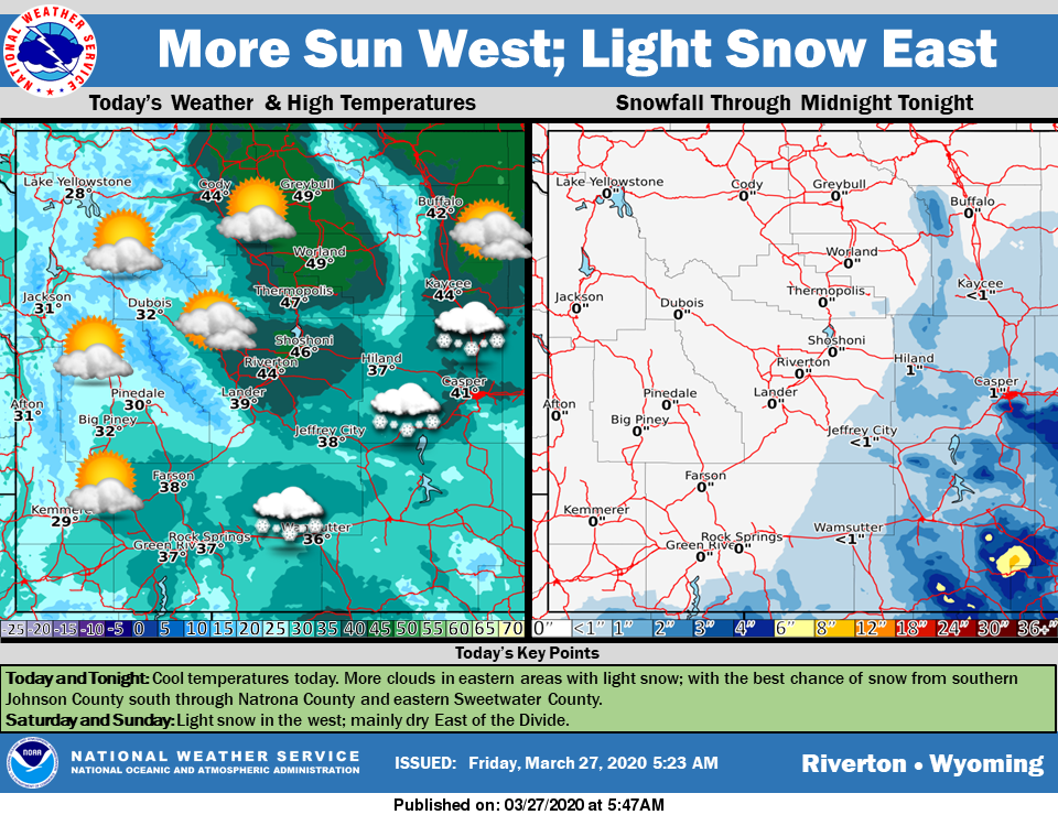
Weather Story
Mainly dry and cool for the west. Some snow is likely in eastern areas with the steadiest snow from Johnson County through Natrona County and eastern Sweetwater County. The best chance of accumulating snow will be in eastern Natrona County, including Casper.
– Detailed Forecast –
Today
A 20 percent chance of snow before 8am. Mostly cloudy, with a high near 37. Breezy, with a west wind 8 to 15 mph, with gusts as high as 22 mph.
Tonight
Partly cloudy, with a low around 20. Breezy, with a west wind 14 to 16 mph, with gusts as high as 23 mph.
Saturday
Mostly sunny, with a high near 41. Breezy, with a west wind 15 to 24 mph, with gusts as high as 33 mph.
Saturday Night
Mostly clear, with a low around 22. Breezy, with a west southwest wind 17 to 22 mph decreasing to 7 to 12 mph after midnight. Winds could gust as high as 30 mph.
Sunday
Mostly sunny, with a high near 47. South southwest wind 6 to 10 mph.
Sunday Night
Mostly cloudy, with a low around 24. South southwest wind 6 to 10 mph.
Monday
Mostly sunny, with a high near 47. Breezy, with a west wind 6 to 11 mph increasing to 13 to 18 mph in the afternoon. Winds could gust as high as 29 mph.
Monday Night
Partly cloudy, with a low around 30. Breezy.
Tuesday
Mostly sunny, with a high near 52. Windy.
Tuesday Night
Partly cloudy, with a low around 29. Windy.
Wednesday
Mostly sunny, with a high near 50.
Wednesday Night
Partly cloudy, with a low around 27.
Thursday
Partly sunny, with a high near 54.
Whatever the weather, have a wonderful day!
From all of us here at SweetwaterNOW

