
Weather Story
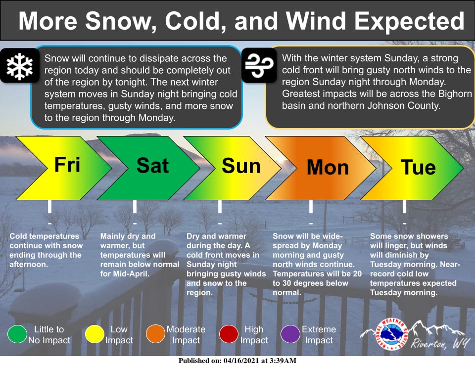
A winter system will drop down out of Canada and impact the region Sunday night through Monday. Near-record cold temperatures, strong northerly winds, and accumulating snowfall are expected across the region to start the work week.
– Detailed Forecast –
Today
Scattered flurries before 2pm, then scattered sprinkles and flurries between 2pm and 4pm, then scattered sprinkles after 4pm. Mostly cloudy, with a high near 37. Breezy, with an east northeast wind 10 to 18 mph, with gusts as high as 26 mph.
Tonight
Partly cloudy, with a low around 20. Blustery, with an east northeast wind 10 to 18 mph, with gusts as high as 28 mph.
Saturday
Sunny, with a high near 42. Breezy, with an east northeast wind 10 to 16 mph.
Saturday Night
Clear, with a low around 24. Northeast wind 9 to 14 mph becoming light and variable. Winds could gust as high as 20 mph.
Sunday
Sunny, with a high near 49. West wind 6 to 14 mph, with gusts as high as 21 mph.
Sunday Night
Partly cloudy, with a low around 26. Blustery, with a west wind 10 to 17 mph becoming south southwest after midnight. Winds could gust as high as 24 mph.
Monday
A 40 percent chance of snow showers after 7am. Partly sunny, with a high near 30. Blustery, with an east northeast wind 15 to 22 mph, with gusts as high as 32 mph.
Monday Night
A 40 percent chance of snow showers before 7pm. Partly cloudy, with a low around 16. Blustery.
Tuesday
Sunny, with a high near 37.
Tuesday Night
Partly cloudy, with a low around 20.
Wednesday
Mostly sunny, with a high near 45.
Wednesday Night
Mostly cloudy, with a low around 27.
Thursday
A slight chance of showers. Mostly sunny, with a high near 50.
Whatever the weather, have a wonderful day!
From all of us here at SweetwaterNOW

