
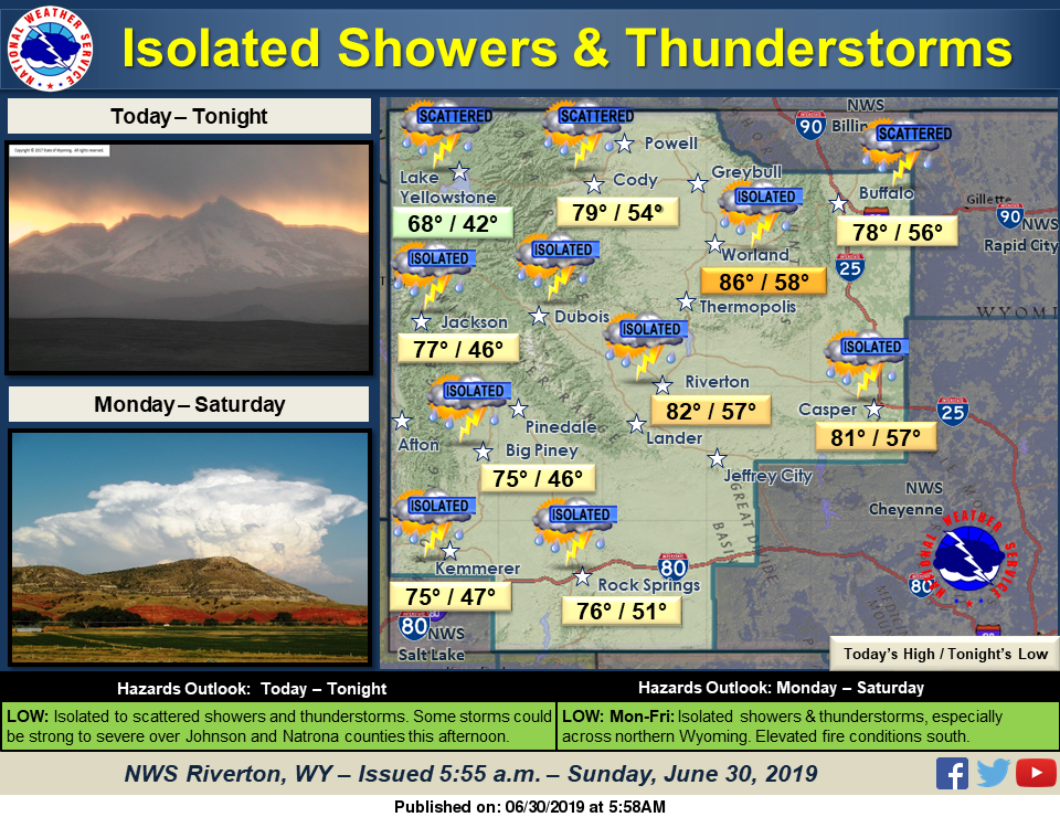
Isolated to scattered showers and thunderstorms today. A few storms over Johnson and Natrona counties could be strong to severe this afternoon.
Detailed Forecast
Today
Scattered showers, with thunderstorms also possible after 1pm. Mostly cloudy, with a high near 76. Breezy, with a south wind 5 to 15 mph, with gusts as high as 23 mph. Chance of precipitation is 50%.
Tonight
Showers likely and possibly a thunderstorm before 10pm, then isolated showers between 10pm and midnight. Cloudy, then gradually becoming partly cloudy, with a low around 52. Breezy, with a south southwest wind 6 to 15 mph, with gusts as high as 22 mph. Chance of precipitation is 60%.
Monday
Sunny, with a high near 81. South southwest wind 5 to 10 mph becoming west in the afternoon.
Monday Night
Partly cloudy, with a low around 53. West southwest wind 8 to 13 mph becoming light and variable in the evening.
Tuesday
Sunny, with a high near 82. Light south wind becoming west southwest 6 to 11 mph in the afternoon.
Tuesday Night
Partly cloudy, with a low around 54. West southwest wind 6 to 11 mph becoming light and variable after midnight. Winds could gust as high as 20 mph.
Wednesday
Mostly sunny, with a high near 84. Light and variable wind becoming west southwest 9 to 14 mph in the morning. Winds could gust as high as 24 mph.
Wednesday Night
Partly cloudy, with a low around 52.
Independence Day
Sunny, with a high near 82.
Thursday Night
Partly cloudy, with a low around 51.
Friday
Sunny, with a high near 81.
Friday Night
Partly cloudy, with a low around 52.
Advertisement - Story continues below...
Saturday
Sunny, with a high near 81.

