
Weather Story
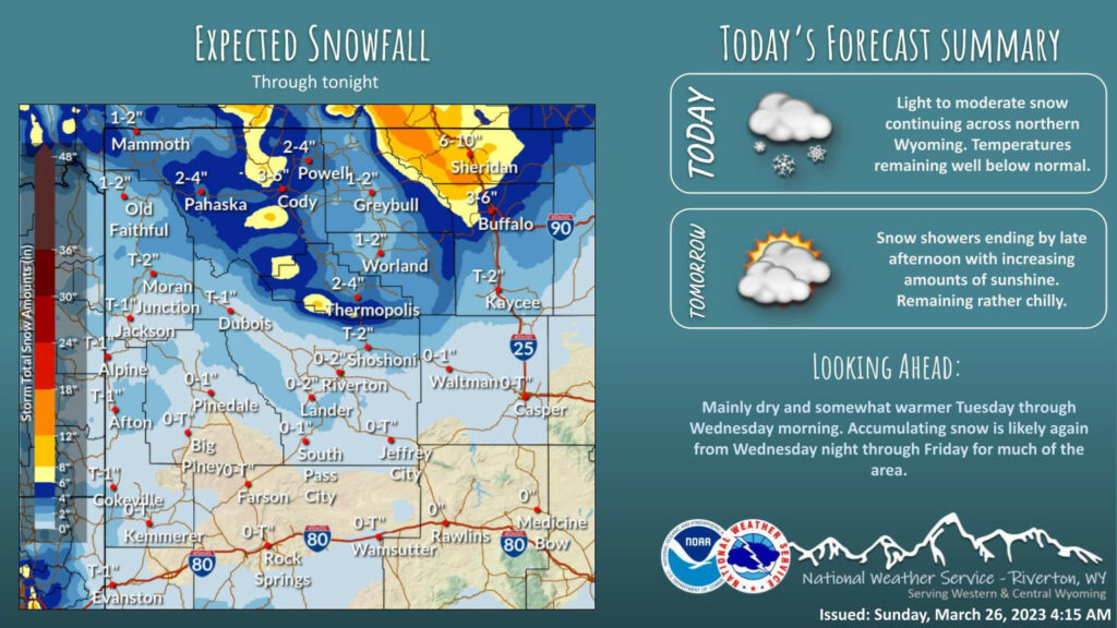
Light to occasionally moderate snow continuing across northern Wyoming, ending on Monday. Temperatures remaining chilly. Dry conditions expected from Monday night through Wednesday morning before the next chance of snow arrives.
– Detailed Forecast –
Today
Mostly sunny, with a high near 24. Wind chill values as low as -5. Southwest wind 6 to 11 mph.
Tonight
Mostly cloudy, with a low around 9. Wind chill values as low as -5. West wind 8 to 11 mph.
Monday
Partly sunny, with a high near 27. Wind chill values as low as -5. West wind around 10 mph.
Monday Night
Mostly clear, with a low around 5. Wind chill values as low as zero. West southwest wind 5 to 8 mph becoming south southeast after midnight.
Tuesday
Mostly sunny, with a high near 31. Southeast wind 5 to 7 mph.
Tuesday Night
Mostly cloudy, with a low around 16. South southeast wind around 7 mph.
Wednesday
Mostly cloudy, with a high near 41. East southeast wind 6 to 14 mph becoming south in the afternoon. Winds could gust as high as 21 mph.
Wednesday Night
A 30 percent chance of snow showers, mainly after midnight. Mostly cloudy, with a low around 26. Breezy.
Thursday
A 30 percent chance of snow showers. Partly sunny, with a high near 39.
Thursday Night
A 30 percent chance of snow showers, mainly before midnight. Mostly cloudy, with a low around 24. Breezy.
Friday
Partly sunny, with a high near 37. Breezy.
Friday Night
Partly cloudy, with a low around 22. Breezy.
Saturday
Mostly sunny, with a high near 41.
Whatever the weather, have a wonderful day!
From all of us here at SweetwaterNOW

