
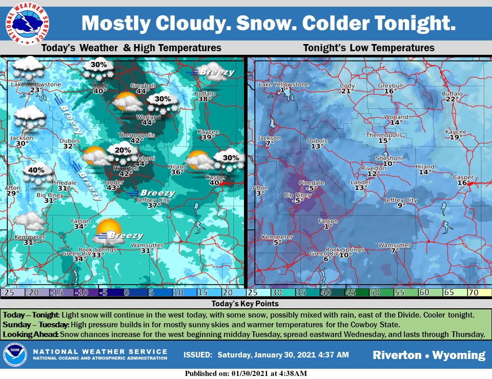
Weather Story
Light snow will continue across the west today, with some showers east of the Divide as well. Light accumulations are expected for most areas, although a Winter Weather Advisory is in effect until noon. Colder tonight with clearing skies, and then high pressure Sunday to Tuesday, with warmer temperatures.
– Detailed Forecast –
Today
Mostly sunny, with a high near 34. Breezy, with a west wind 18 to 20 mph, with gusts as high as 30 mph.
Tonight
Mostly clear, with a low around 8. Wind chill values as low as -5. West wind 8 to 14 mph, with gusts as high as 21 mph.
Sunday
Sunny, with a high near 32. Wind chill values as low as -5. South southeast wind around 8 mph becoming north northwest in the afternoon.
Sunday Night
Partly cloudy, with a low around 10. Wind chill values as low as zero. South southwest wind around 7 mph.
Monday
Partly sunny, with a high near 34. South southwest wind around 7 mph.
Monday Night
Partly cloudy, with a low around 16. South southwest wind around 7 mph.
Tuesday
Mostly sunny, with a high near 39. South southeast wind 7 to 9 mph.
Tuesday Night
A 30 percent chance of snow showers after 11pm. Mostly cloudy, with a low around 19.
Wednesday
A 40 percent chance of snow showers. Partly sunny, with a high near 36.
Wednesday Night
A 40 percent chance of snow showers, mainly before 11pm. Mostly cloudy, with a low around 12. Blustery.
Thursday
Mostly sunny, with a high near 25. Breezy.
Thursday Night
Partly cloudy, with a low around 18. Breezy.
Friday
A chance of snow showers. Partly sunny, with a high near 28. Blustery.
Whatever the weather, have a wonderful day!
From all of us here at SweetwaterNOW

