
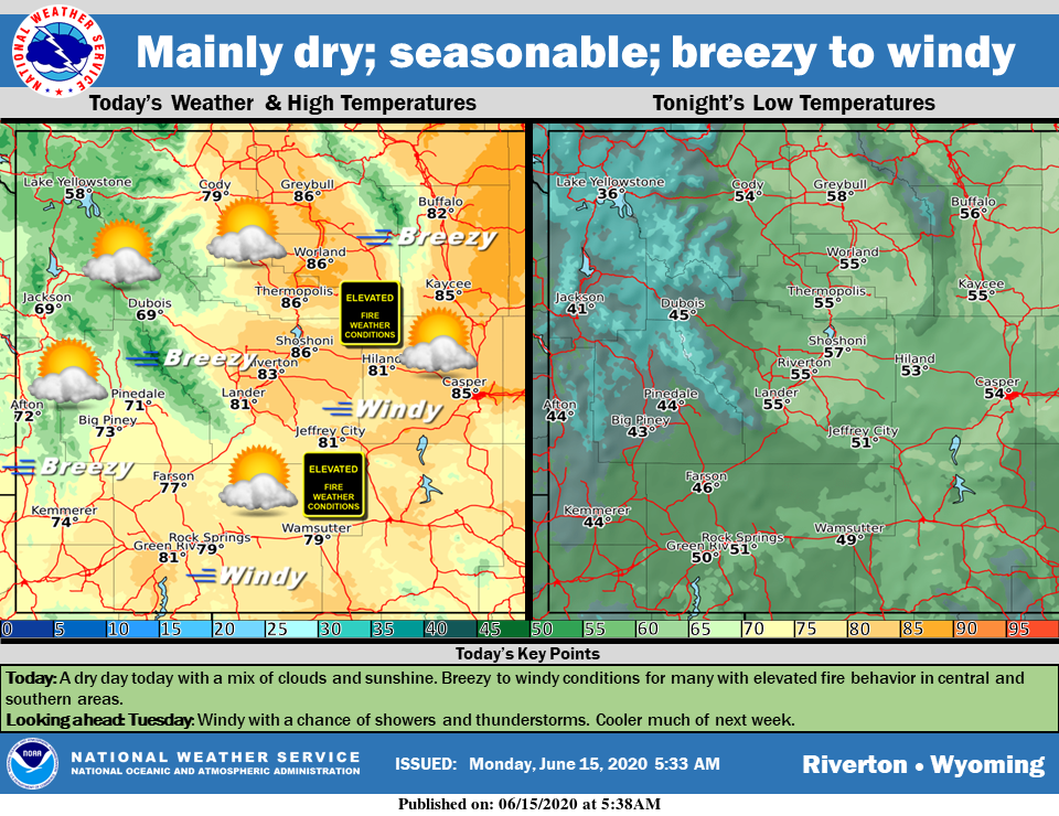
Weather Story
A dry and seasonable start to the week with a mixture of clouds and sunshine. Although not as windy as the weekend, low humidity and a continued gusty wind will bring elevated fire conditions to much of central and southern Wyoming this afternoon. A cold front will approach later tonight into Tuesday and bring a chance of showers and thunderstorms. Cooler temperatures are expected much of next week.
– Detailed Forecast –
Today
Mostly sunny, with a high near 79. Breezy, with a southwest wind 7 to 12 mph increasing to 15 to 20 mph in the afternoon. Winds could gust as high as 28 mph
Tonight
Partly cloudy, with a low around 50. Breezy, with a south southwest wind 9 to 18 mph, with gusts as high as 25 mph.
Tuesday
Isolated showers and thunderstorms after noon. Partly sunny, with a high near 74. Breezy, with a south southwest wind 10 to 15 mph becoming west 17 to 22 mph in the afternoon. Winds could gust as high as 31 mph. Chance of precipitation is 20%.
Tuesday Night
Isolated showers and thunderstorms, then scattered showers after midnight. Mostly cloudy, with a low around 41. Breezy, with a west northwest wind 10 to 17 mph, with gusts as high as 24 mph. Chance of precipitation is 30%.
Wednesday
Isolated showers before noon. Mostly sunny, with a high near 62. Breezy, with a west wind 14 to 20 mph, with gusts as high as 28 mph. Chance of precipitation is 20%.
Wednesday Night
Mostly clear, with a low around 35. Breezy, with a west northwest wind 16 to 21 mph decreasing to 5 to 10 mph after midnight. Winds could gust as high as 29 mph.
Thursday
Mostly sunny, with a high near 67. West wind 6 to 14 mph, with gusts as high as 23 mph.
Thursday Night
Partly cloudy, with a low around 42.
Friday
Mostly sunny, with a high near 72.
Friday Night
Mostly clear, with a low around 44.
Saturday
Sunny, with a high near 77.
Saturday Night
Mostly clear, with a low around 47.
Sunday
Sunny, with a high near 81.
Whatever the weather, have a wonderful day!
From all of us here at SweetwaterNOW

