
Weather Story
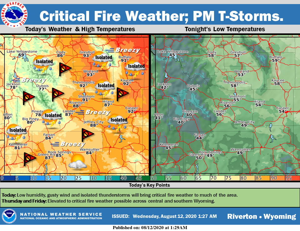
A weather system will cross the area today and bring isolated thunderstorms. With breezy conditions and low humidity critical fire weather will remain likely across the area today and tomorrow.
– Detailed Forecast –
Today
Isolated showers and thunderstorms between 3pm and 4pm. Mostly sunny, with a high near 84. Breezy, with a west southwest wind 6 to 11 mph increasing to 13 to 18 mph in the afternoon. Winds could gust as high as 25 mph. Chance of precipitation is 20%.
Tonight
Mostly clear, with a low around 50. Breezy, with a south southwest wind 12 to 17 mph decreasing to 6 to 11 mph after midnight. Winds could gust as high as 24 mph.
Thursday
Sunny, with a high near 87. Breezy, with a south wind 6 to 11 mph becoming west 17 to 22 mph in the afternoon. Winds could gust as high as 31 mph.
Thursday Night
Clear, with a low around 49. Breezy, with a west wind 16 to 21 mph decreasing to 6 to 11 mph after midnight. Winds could gust as high as 29 mph.
Friday
Sunny, with a high near 84. Breezy, with a west wind 5 to 10 mph increasing to 15 to 20 mph in the afternoon. Winds could gust as high as 28 mph.
Friday Night
Mostly clear, with a low around 48. Breezy, with a west northwest wind 15 to 20 mph decreasing to 5 to 10 mph after midnight. Winds could gust as high as 28 mph.
Saturday
Sunny, with a high near 87. Breezy, with a southwest wind 5 to 15 mph becoming west northwest in the afternoon. Winds could gust as high as 28 mph.
Saturday Night
Clear, with a low around 51.
Sunday
Sunny, with a high near 87.
Sunday Night
Mostly clear, with a low around 52.
Monday
Mostly sunny, with a high near 88.
Monday Night
Partly cloudy, with a low around 55.
Tuesday
Mostly sunny, with a high near 88.
Whatever the weather, have a wonderful day!
From all of us here at SweetwaterNOW