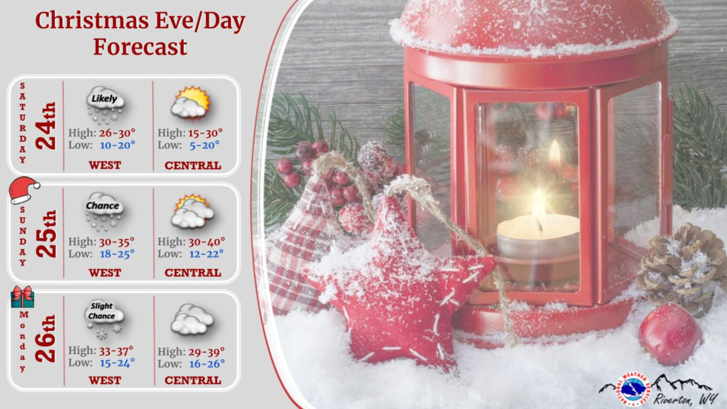

Weather Story
A welcomed warm-up is in store for most this Christmas Eve, except the Wind River and Bighorn Basins who will remain in a cold pool. West of the Divide can expect snow to fall periodically throughout the day.
– Detailed Forecast –
Today
Cloudy through mid morning, then gradual clearing, with a high near 33. Breezy, with a west wind 15 to 23 mph, with gusts as high as 32 mph.
Tonight
Mostly cloudy, with a low around 21. Breezy, with a west southwest wind 14 to 21 mph, with gusts as high as 26 mph.
Christmas Day
Mostly cloudy, with a high near 37. Breezy, with a west southwest wind 15 to 23 mph, with gusts as high as 32 mph.
Sunday Night
Mostly cloudy, with a low around 27. Breezy, with a west wind 13 to 17 mph, with gusts as high as 26 mph.
Monday
Mostly cloudy, with a high near 36. West southwest wind 7 to 11 mph.
Monday Night
Mostly cloudy, with a low around 20. South southwest wind 6 to 8 mph.
Tuesday
A chance of snow before 1pm, then a chance of rain and snow. Mostly cloudy, with a high near 37. South wind 9 to 13 mph, with gusts as high as 20 mph. Chance of precipitation is 40%.
Tuesday Night
A chance of rain and snow before 9pm, then snow likely. Mostly cloudy, with a low around 26. Breezy. Chance of precipitation is 60%.
Wednesday
A 30 percent chance of snow, mainly before 11am. Mostly cloudy, with a high near 32. Breezy.
Wednesday Night
Mostly cloudy, with a low around 9. Breezy.
Thursday
A slight chance of snow. Partly sunny, with a high near 23.
Thursday Night
A slight chance of snow. Mostly cloudy, with a low around 11.
Friday
A slight chance of snow. Partly sunny, with a high near 26.
Whatever the weather, have a wonderful day!
From all of us here at SweetwaterNOW