
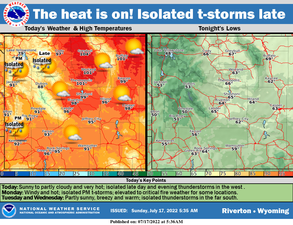
Weather Story
To quote Glenn Frey, “The Heat Is On!” (Cue saxophone solo). Near record heat for many today. Isolated late day thunderstorms in the west. Remaining hot and becoming windy tomorrow with critical fire weather possible.
– Detailed Forecast –
Today
Sunny, with a high near 95. Light and variable wind becoming south 6 to 11 mph in the morning.
Tonight
Partly cloudy, with a low around 62. South southwest wind 7 to 13 mph, with gusts as high as 20 mph.
Monday
Isolated showers and thunderstorms after 1pm. Some of the storms could produce gusty winds. Mostly sunny, with a high near 91. Breezy, with a west southwest wind 6 to 11 mph increasing to 19 to 24 mph in the afternoon. Winds could gust as high as 37 mph. Chance of precipitation is 20%.
Monday Night
Isolated showers and thunderstorms before 7pm. Some of the storms could produce gusty winds. Partly cloudy, with a low around 59. Breezy, with a west southwest wind 18 to 23 mph decreasing to 7 to 12 mph after midnight. Winds could gust as high as 34 mph. Chance of precipitation is 20%.
Tuesday
Sunny, with a high near 88. Breezy, with a west wind 6 to 11 mph increasing to 17 to 22 mph in the afternoon. Winds could gust as high as 33 mph.
Tuesday Night
Partly cloudy, with a low around 57. Breezy, with a west wind 17 to 22 mph decreasing to 6 to 11 mph after midnight. Winds could gust as high as 33 mph.
Wednesday
Sunny, with a high near 88. Breezy, with a west wind 6 to 15 mph, with gusts as high as 22 mph.
Wednesday Night
Partly cloudy, with a low around 59. Breezy.
Thursday
Sunny, with a high near 88.
Thursday Night
Partly cloudy, with a low around 60.
Friday
Mostly sunny, with a high near 88. Breezy.
Friday Night
Mostly cloudy, with a low around 59. Breezy.
Saturday
Mostly sunny, with a high near 85.
Whatever the weather, have a wonderful day!
From all of us here at SweetwaterNOW

