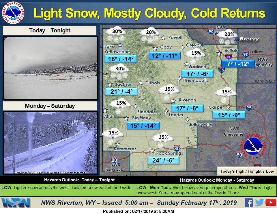

Light snow showers can be expected again today, mainly in the west and in the mountains. Arctic air will settle across the area and keep temperatures low today. Temperatures will be much colder especially tonight and Monday, but below normal temperatures can be expected most of the week.
Detailed Forecast
Today
Partly sunny, with a high near 22. Wind chill values as low as -5. Southwest wind 5 to 8 mph becoming east in the afternoon.
Tonight
Mostly cloudy, with a low around -6. Wind chill values as low as -20. East northeast wind 10 to 14 mph, with gusts as high as 20 mph.
Monday
Mostly cloudy and cold, with a high near 10. Wind chill values as low as -25. East northeast wind around 11 mph.
Monday Night
Mostly cloudy, with a low around -8. Wind chill values as low as -20. East northeast wind around 8 mph becoming north northwest after midnight.
Tuesday
Mostly cloudy and cold, with a high near 10. West wind 6 to 9 mph.
Tuesday Night
Mostly cloudy, with a low around -5. West wind around 11 mph.
Wednesday
Partly sunny, with a high near 16. West southwest wind around 10 mph.
Wednesday Night
Mostly cloudy, with a low around -1.
Thursday
A 20 percent chance of snow showers. Mostly cloudy, with a high near 19.
Thursday Night
A 20 percent chance of snow showers. Mostly cloudy, with a low around 5. Blustery.
Friday
A slight chance of snow showers. Mostly cloudy, with a high near 20.
Friday Night
Partly cloudy, with a low around 1.
Saturday
Mostly sunny, with a high near 24.
Advertisement - Story continues below...