
Weather Story
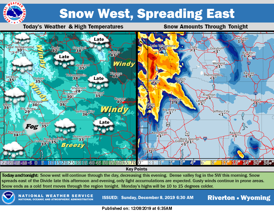
Snow will continue across the west through this afternoon and then decrease this evening. East of the Divide, snow will begin late this afternoon and evening. All snowfall ends as a cold front moves through tonight. Winds will not be as strong as on Saturday, but will continue to be gusty in the same locations.
– Detailed Forecast –
Today
A 40 percent chance of snow, mainly between 8am and 2pm. Patchy fog before 1pm. Otherwise, partly sunny, with a high near 35. Breezy, with a west southwest wind 8 to 16 mph, with gusts as high as 22 mph. Total daytime snow accumulation of less than a half inch possible.
Tonight
A 40 percent chance of snow after midnight. Partly cloudy, with a low around 18. Breezy, with a west wind 13 to 17 mph, with gusts as high as 22 mph. New snow accumulation of less than a half inch possible.
Monday
Partly sunny, with a high near 27. West wind 7 to 10 mph.
Monday Night
Mostly cloudy, with a low around 13. Wind chill values as low as zero. West wind around 11 mph.
Tuesday
Partly sunny, with a high near 29. West wind 10 to 13 mph, with gusts as high as 20 mph.
Tuesday Night
Mostly cloudy, with a low around 14. Southwest wind 7 to 10 mph.
Wednesday
Mostly cloudy, with a high near 30. Southwest wind 5 to 8 mph.
Wednesday Night
Partly cloudy, with a low around 14.
Thursday
Partly sunny, with a high near 32.
Thursday Night
A 20 percent chance of snow after midnight. Mostly cloudy, with a low around 22.
Friday
A chance of snow. Mostly cloudy, with a high near 37.
Friday Night
A slight chance of snow. Mostly cloudy, with a low around 24.
Saturday
A chance of snow. Mostly cloudy, with a high near 33. Breezy.
Whatever the weather, have a wonderful day!
From all of us here at SweetwaterNOW