
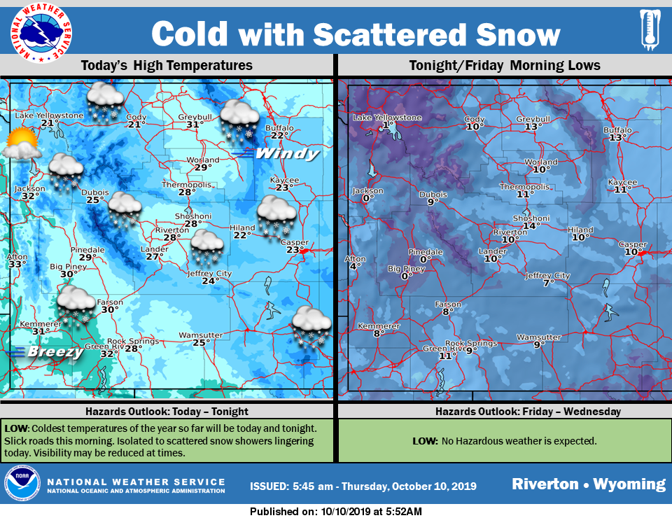
Isolated to scattered snow showers will linger across the area today. Most showers will be light, but some could reduce visibility at times. Temperatures will be below normal with highs at or below freezing and lows Friday morning in the teens and single digits. Expect a few negative temperatures in the usual cold sp
Detailed Forecast
Today
Isolated snow showers. Partly sunny, with a high near 29. Wind chill values as low as -5. Blustery, with an east northeast wind 13 to 18 mph becoming northwest 6 to 11 mph in the afternoon. Winds could gust as high as 28 mph. Chance of precipitation is 20%.
Tonight
Mostly clear, with a low around 10. Wind chill values as low as zero. West northwest wind 5 to 9 mph becoming north northeast in the evening.
Friday
Sunny, with a high near 43. Wind chill values as low as -5. West southwest wind 9 to 11 mph.
Friday Night
Mostly clear, with a low around 20. Southwest wind 5 to 8 mph.
Saturday
Sunny, with a high near 56. West wind 5 to 10 mph.
Saturday Night
Mostly clear, with a low around 27. West southwest wind 6 to 9 mph.
Sunday
Sunny, with a high near 59.
Sunday Night
Partly cloudy, with a low around 32.
Monday
Mostly sunny, with a high near 57. Breezy.
Monday Night
Mostly clear, with a low around 29.
Tuesday
Sunny, with a high near 59.
Tuesday Night
Mostly clear, with a low around 32.
Wednesday
Mostly sunny, with a high near 62.
Advertisement - Story continues below...

