
Weather Story
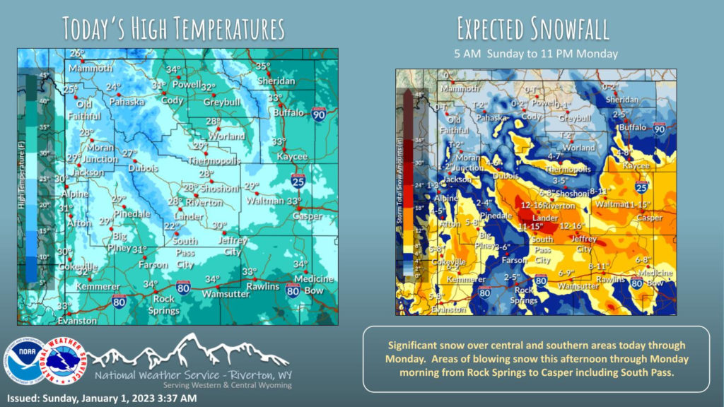
A winter storm will impact much of western and central Wyoming today and Monday. The heaviest snow will occur across central and southern sections.
– Detailed Forecast –
Today
Snow showers. High near 34. Breezy, with an east wind 14 to 18 mph, with gusts as high as 29 mph. Chance of precipitation is 90%. Total daytime snow accumulation of 1 to 2 inches possible.
Tonight
Snow showers. Patchy blowing snow. Low around 21. Windy, with an east northeast wind 23 to 26 mph, with gusts as high as 39 mph. Chance of precipitation is 90%. New snow accumulation of 1 to 2 inches possible.
Monday
Snow showers likely, mainly before 3pm. Patchy blowing snow before 8am. Cloudy, with a high near 27. Blustery, with a northeast wind 10 to 20 mph, with gusts as high as 30 mph. Chance of precipitation is 70%. New snow accumulation of around an inch possible.
Monday Night
Mostly cloudy, with a low around 12. East wind around 8 mph becoming southwest after midnight.
Tuesday
Partly sunny, with a high near 24. West southwest wind 9 to 14 mph, with gusts as high as 21 mph.
Tuesday Night
Partly cloudy, with a low around 7. West southwest wind 9 to 13 mph.
Wednesday
Mostly sunny, with a high near 22. West southwest wind 8 to 10 mph.
Wednesday Night
Partly cloudy, with a low around 6.
Thursday
Partly sunny, with a high near 26.
Thursday Night
A 20 percent chance of snow showers. Mostly cloudy, with a low around 15.
Friday
A slight chance of snow showers. Mostly cloudy, with a high near 29.
Friday Night
Partly cloudy, with a low around 13.
Saturday
Partly sunny, with a high near 27.
Whatever the weather, have a wonderful day!
From all of us here at SweetwaterNOW