
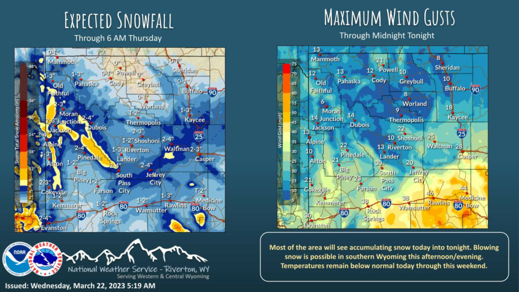
Weather Story
Snow falls today into tonight for most of the area. Gusty winds across southern Wyoming may lead to blowing snow and travel issues along I-80. Winter Weather Advisories remain in effect through 11 PM MDT tonight east of the Continental Divide and through 6 AM MDT Thursday west of the Continental Divide.
– Detailed Forecast –
Today
Snow showers, mainly after 11am. High near 36. Windy, with an east northeast wind 5 to 10 mph becoming west 18 to 28 mph in the morning. Winds could gust as high as 37 mph. Chance of precipitation is 80%. Total daytime snow accumulation of less than one inch possible.
Tonight
A 50 percent chance of snow showers, mainly before 11pm. Mostly cloudy, with a low around 21. West southwest wind 9 to 13 mph, with gusts as high as 23 mph. New snow accumulation of less than a half inch possible.
Thursday
A slight chance of snow showers between 8am and 3pm. Mostly sunny, with a high near 37. Breezy, with a west southwest wind 11 to 16 mph, with gusts as high as 21 mph. Chance of precipitation is 20%.
Thursday Night
Mostly cloudy, with a low around 19. Southwest wind 8 to 14 mph.
Friday
A 30 percent chance of snow showers after noon. Partly sunny, with a high near 31. Windy, with a west southwest wind 9 to 19 mph increasing to 19 to 29 mph in the afternoon. Winds could gust as high as 43 mph.
Friday Night
Partly cloudy, with a low around 11. Windy, with a west wind 24 to 29 mph decreasing to 15 to 20 mph after midnight. Winds could gust as high as 43 mph.
Saturday
Mostly sunny, with a high near 26. Breezy, with a west wind 13 to 17 mph, with gusts as high as 28 mph.
Saturday Night
Mostly cloudy, with a low around 6.
Sunday
Partly sunny, with a high near 25.
Sunday Night
Mostly cloudy, with a low around 10.
Monday
Mostly sunny, with a high near 28.
Monday Night
Partly cloudy, with a low around 9.
Tuesday
Mostly sunny, with a high near 32.
Whatever the weather, have a wonderful day!
From all of us here at SweetwaterNOW

