
Weather Story
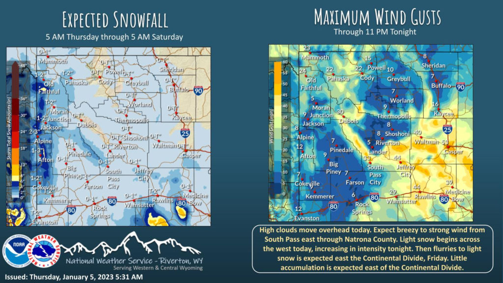
Snow moves into the west again today, increasing tonight. Breezy to windy conditions will occur in portions of Fremont and Natrona County today. Snow moves east on Friday with little accumulation expected. Temperatures remain similar to yesterday.
– Detailed Forecast –
Today
Partly sunny, with a high near 28. North northeast wind 3 to 6 mph.
Tonight
Snow showers likely, mainly after 5am. Mostly cloudy, with a low around 14. Light and variable wind becoming north around 6 mph after midnight. Chance of precipitation is 60%. New snow accumulation of less than a half inch possible.
Friday
Snow showers likely, mainly before 9am. Patchy blowing snow after 1pm. Mostly cloudy, with a high near 32. Breezy, with a west southwest wind 8 to 18 mph, with gusts as high as 26 mph. Chance of precipitation is 60%. New snow accumulation of less than a half inch possible.
Friday Night
Mostly cloudy, with a low around 15. Wind chill values as low as zero. Breezy, with a west wind 13 to 16 mph, with gusts as high as 24 mph.
Saturday
Mostly sunny, with a high near 28. West southwest wind 7 to 11 mph.
Saturday Night
Mostly cloudy, with a low around 10. South wind around 6 mph.
Sunday
Partly sunny, with a high near 27. South wind around 7 mph.
Sunday Night
Mostly cloudy, with a low around 12.
Monday
Partly sunny, with a high near 29.
Monday Night
Partly sunny, with a high near 29.
Tuesday
A chance of snow. Mostly cloudy, with a high near 34.
Tuesday Night
A chance of snow. Mostly cloudy, with a low around 18.
Wednesday
A chance of snow. Partly sunny, with a high near 32.
Whatever the weather, have a wonderful day!
From all of us here at SweetwaterNOW

