
Weather Story
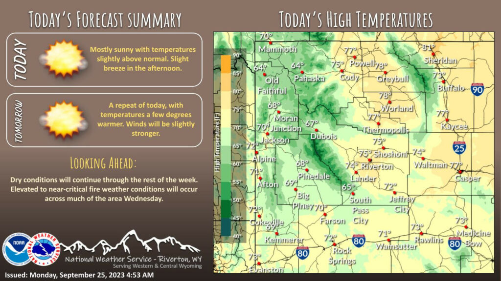
Dry conditions and mainly light winds continue today. A warming trend also begins today, with elevated to near-critical fire weather conditions will occur Tuesday and Wednesday from eastern Sweetwater County to Natrona County, including southern Fremont County.
– Detailed Forecast –
Today
Sunny, with a high near 71. Calm wind becoming west southwest around 6 mph in the afternoon.
Tonight
Mostly clear, with a low around 43. North wind around 6 mph becoming south after midnight.
Tuesday
Sunny, with a high near 73. Light and variable wind becoming west southwest 5 to 8 mph in the afternoon.
Tuesday Night
Clear, with a low around 43. West wind 5 to 8 mph becoming light and variable after midnight.
Wednesday
Sunny, with a high near 77. Light and variable wind becoming west 8 to 13 mph in the morning.
Wednesday Night
Mostly clear, with a low around 43. West wind 5 to 13 mph becoming south after midnight.
Thursday
Sunny, with a high near 73. Breezy, with a south wind 6 to 15 mph becoming west in the afternoon. Winds could gust as high as 22 mph.
Thursday Night
Mostly clear, with a low around 42.
Friday
Sunny, with a high near 72. Breezy.
Friday Night
A 20 percent chance of showers after midnight. Mostly cloudy, with a low around 44. Breezy.
Saturday
A chance of showers. Mostly sunny, with a high near 67. Breezy.
Saturday Night
A chance of showers. Mostly cloudy, with a low around 41. Breezy.
Sunday
A chance of showers. Partly sunny, with a high near 62. Breezy.
Whatever the weather, have a wonderful day!
From all of us here at SweetwaterNOW

