
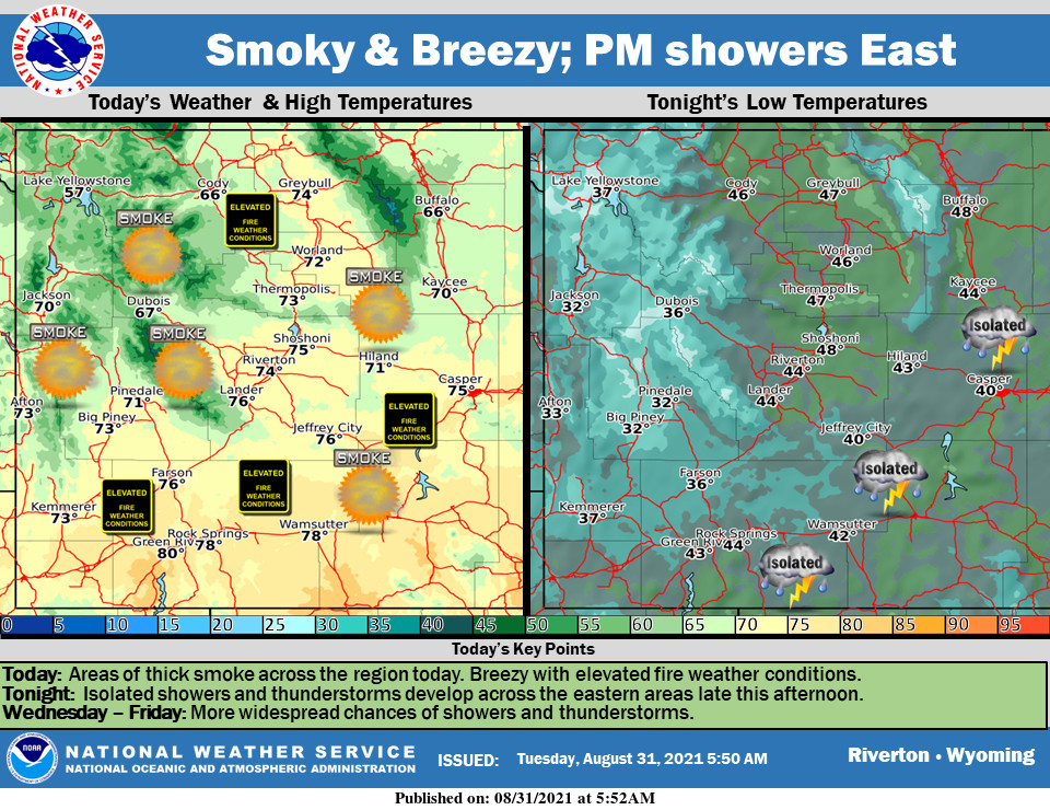
Weather Story
A Red Flag Warning is in effect from 12-8 for the south and central areas and portions of Johnson County. Mostly sunny otherwise with areas of smoke today. Isolated showers and storms are possible in the afternoon and evening across the northwest.
– Detailed Forecast –
Today
Patchy smoke. Sunny, with a high near 82. Breezy, with a south southeast wind 5 to 10 mph becoming west southwest 15 to 20 mph in the afternoon. Winds could gust as high as 29 mph.
Tonight
Isolated showers before 8pm, then scattered showers after 4am. Patchy smoke. Partly cloudy, with a low around 55. Breezy, with a south southwest wind 15 to 20 mph decreasing to 6 to 11 mph after midnight. Winds could gust as high as 30 mph. Chance of precipitation is 30%.
Thursday
Scattered showers, with thunderstorms also possible after noon. Patchy smoke. Mostly sunny, with a high near 76. Breezy, with a south southwest wind 8 to 18 mph, with gusts as high as 28 mph. Chance of precipitation is 40%.
Thursday Night
Mostly clear, with a low around 48. Breezy, with a south southwest wind 8 to 18 mph, with gusts as high as 28 mph.
Friday
Sunny, with a high near 80. Breezy, with a south southwest wind 6 to 11 mph becoming west 16 to 21 mph in the afternoon. Winds could gust as high as 31 mph.
Friday Night
Mostly clear, with a low around 49. Breezy, with a west wind 16 to 21 mph becoming light and variable. Winds could gust as high as 31 mph.
Saturday
Sunny, with a high near 79. Breezy, with a west southwest wind 6 to 11 mph becoming west northwest 13 to 18 mph in the afternoon. Winds could gust as high as 28 mph.
Saturday Night
Mostly clear, with a low around 45. Breezy.
Sunday
Sunny, with a high near 80.
Sunday Night
Mostly clear, with a low around 51.
Monday
Sunny, with a high near 83. Breezy.
Monday Night
Mostly clear, with a low around 52. Breezy
Tuesday
Sunny, with a high near 83.
Whatever the weather, have a wonderful day!
From all of us here at SweetwaterNOW

