
Weather Story
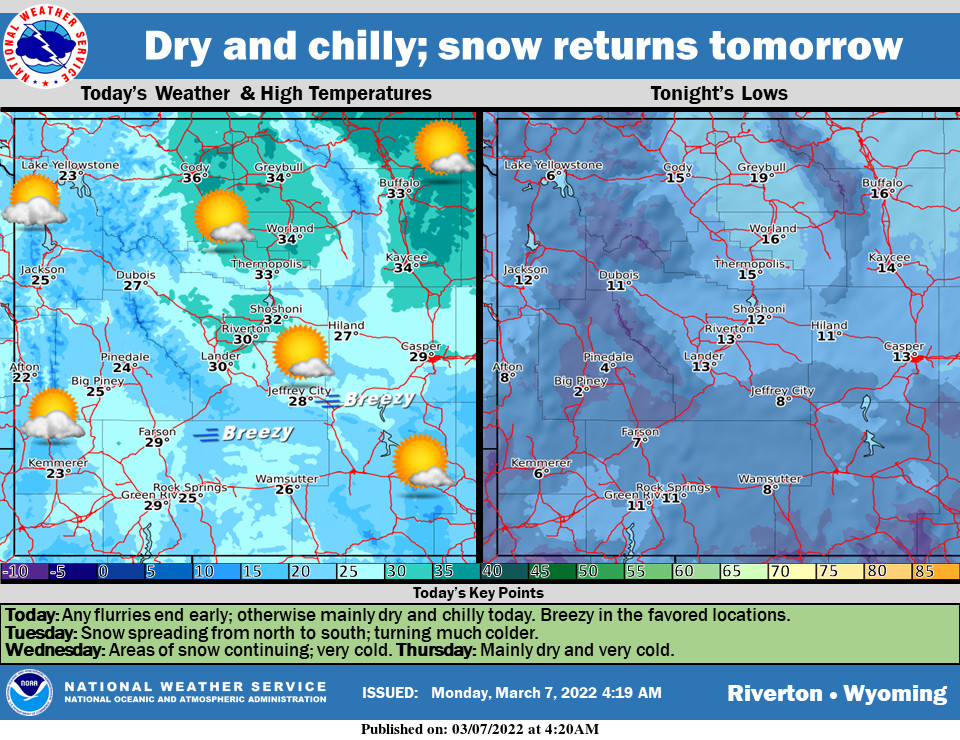
Mainly dry and chilly today with sunshine and some clouds. Some snow will return to the far north tonight. An Arctic Front will bring areas of snow and much colder temperatures Tuesday and Wednesday.
– Detailed Forecast –
Today
Patchy fog before 8am. Otherwise, mostly cloudy through mid morning, then gradual clearing, with a high near 26. Wind chill values as low as zero. Light and variable wind becoming west 9 to 14 mph in the morning. Winds could gust as high as 21 mph.
Tonight
Partly cloudy, with a low around 11. Wind chill values as low as -5. West wind 8 to 14 mph, with gusts as high as 21 mph.
Tuesday
A 20 percent chance of snow after 11am. Partly sunny, with a high near 33. Wind chill values as low as -5. Breezy, with a west wind 17 to 22 mph, with gusts as high as 33 mph.
Tuesday Night
A 50 percent chance of snow. Mostly cloudy, with a low around 14. Breezy, with a west southwest wind 15 to 17 mph, with gusts as high as 26 mph. New snow accumulation of around an inch possible.
Wednesday
Snow. High near 25. Blustery, with a northwest wind 16 to 18 mph becoming east northeast in the afternoon. Winds could gust as high as 28 mph. Chance of precipitation is 80%. New snow accumulation of 1 to 2 inches possible
Wednesday Night
A 20 percent chance of snow before 11pm. Mostly cloudy, with a low around -4. Blustery, with an east northeast wind 10 to 15 mph, with gusts as high as 23 mph.
Thursday
Mostly sunny, with a high near 16. North wind 7 to 14 mph becoming west in the afternoon. Winds could gust as high as 21 mph.
Thursday Night
Partly cloudy, with a low around -1.
Friday
Sunny, with a high near 27. Breezy.
Friday Night
Partly cloudy, with a low around 16. Breezy.
Saturday
Mostly sunny, with a high near 39. Breezy.
Saturday Night
Partly cloudy, with a low around 20. Breezy.
Sunday
Partly sunny, with a high near 43. Breezy.
Whatever the weather, have a wonderful day!
From all of us here at SweetwaterNOW