
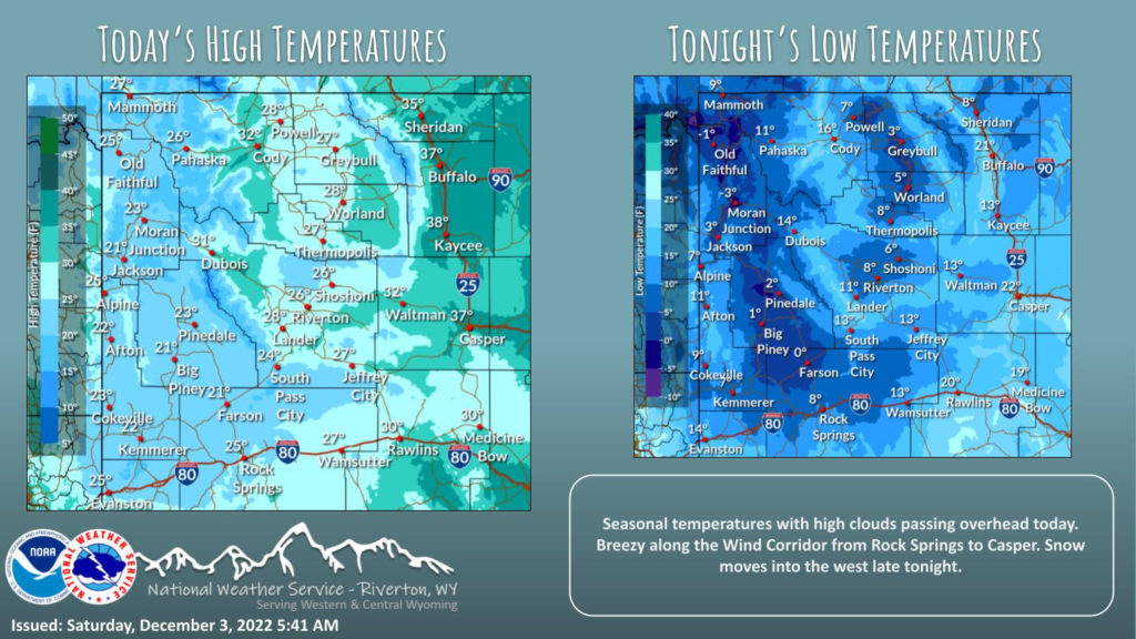
Weather Story
Today will be a quiet day, but breezy wind from the southwest will impact the Wind Corridor from Rock Springs to Casper. Next chance of snow for the west begins tonight. Temperatures will be close to average.
– Detailed Forecast –
Today
Mostly cloudy, with a high near 24. Wind chill values as low as -5. West northwest wind 5 to 8 mph becoming north northeast in the morning.
Tonight
A 10 percent chance of snow after 5am. Mostly cloudy, with a low around 10. Wind chill values as low as zero. Southwest wind around 7 mph becoming east after midnight.
Sunday
Mostly cloudy, with a high near 35. Wind chill values as low as zero. East wind 7 to 10 mph becoming southwest in the afternoon.
Sunday Night
A 30 percent chance of snow showers, mainly after midnight. Mostly cloudy, with a low around 20. West southwest wind 6 to 11 mph.
Monday
A 30 percent chance of snow showers. Mostly cloudy, with a high near 32. West wind 11 to 14 mph, with gusts as high as 21 mph.
Monday Night
Partly cloudy, with a low around 12. West southwest wind 10 to 13 mph, with gusts as high as 20 mph.
Tuesday
Partly sunny, with a high near 25. West southwest wind 10 to 13 mph, with gusts as high as 20 mph.
Tuesday Night
Partly cloudy, with a low around 4.
Wednesday
Partly sunny, with a high near 19.
Wednesday Night
Partly cloudy, with a low around 2.
Thursday
Mostly sunny, with a high near 20.
Thursday Night
Partly cloudy, with a low around 2.
Friday
Partly sunny, with a high near 20.
Whatever the weather, have a wonderful day!
From all of us here at SweetwaterNOW

