
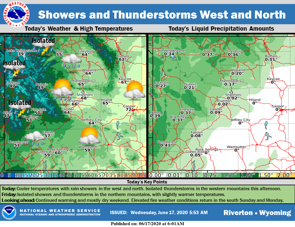
Weather Story
Cooler temperatures today with continued showers in the west and north. Mountain snow is possible above 8000 ft through noon. Isolated thunderstorms are possible in the western mountains this afternoon.
– Detailed Forecast –
Today
Scattered showers, mainly before 8am. Mostly cloudy, then gradually becoming sunny, with a high near 59. Breezy, with a west wind 16 to 22 mph, with gusts as high as 33 mph. Chance of precipitation is 30%.
Tonight
Mostly clear, with a low around 36. Breezy, with a west northwest wind 17 to 22 mph decreasing to 8 to 13 mph after midnight. Winds could gust as high as 31 mph.
Thursday
Sunny, with a high near 65. West southwest wind 5 to 7 mph becoming calm. Winds could gust as high as 20 mph.
Thursday Night
Partly cloudy, with a low around 44. North northwest wind 6 to 8 mph becoming northeast after midnight.
Friday
Mostly sunny, with a high near 70. Northeast wind 6 to 11 mph becoming west in the afternoon.
Friday Night
Mostly clear, with a low around 45. West wind 6 to 11 mph.
Saturday
Mostly sunny, with a high near 74. Breezy, with a west wind 6 to 11 mph increasing to 12 to 17 mph in the afternoon. Winds could gust as high as 26 mph.
Saturday Night
Partly cloudy, with a low around 50.
Sunday
Mostly sunny, with a high near 80.
Sunday Night
Mostly clear, with a low around 52. Breezy.
Monday
Sunny, with a high near 82. Breezy.
Monday Night
Mostly clear, with a low around 53. Breezy.
Tuesday
Sunny, with a high near 83.
Whatever the weather, have a wonderful day!
From all of us here at SweetwaterNOW

