
Weather Story
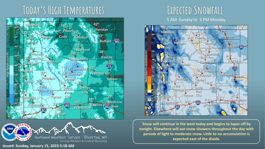
Snow continues out west while snow showers will begin to move in east of the divide. Little to no accumulation is expected out east. Temperatures will stay near normal with the Upper Green River and Wind River Basins being the exception as temperatures will remain cooler.
– Detailed Forecast –
Today
A 30 percent chance of snow, mainly between 11am and 4pm. Mostly cloudy, with a high near 31. East wind 6 to 14 mph becoming west southwest in the morning.
Tonight
A 20 percent chance of snow before 8pm. Mostly cloudy, with a low around 14. Breezy, with a west wind 17 to 22 mph decreasing to 11 to 16 mph after midnight. Winds could gust as high as 30 mph.
Monday
Partly sunny, with a high near 27. Southwest wind 5 to 9 mph becoming light and variable.
Monday Night
Mostly cloudy, with a low around 11. East southeast wind around 5 mph.
Tuesday
A 20 percent chance of snow. Mostly cloudy, with a high near 25. North northeast wind 5 to 7 mph.
Tuesday Night
Mostly cloudy, with a low around 10. North wind around 8 mph becoming west after midnight.
Wednesday
Partly sunny, with a high near 22. Breezy, with a west wind 9 to 15 mph, with gusts as high as 22 mph.
Wednesday Night
Partly cloudy, with a low around 6.
Thursday
A 40 percent chance of snow. Mostly cloudy, with a high near 24.
Thursday Night
A 30 percent chance of snow. Mostly cloudy, with a low around 9.
Friday
Partly sunny, with a high near 21.
Friday Night
Partly cloudy, with a low around 0.
Saturday
Mostly sunny, with a high near 20. Breezy.
Whatever the weather, have a wonderful day!
From all of us here at SweetwaterNOW

