
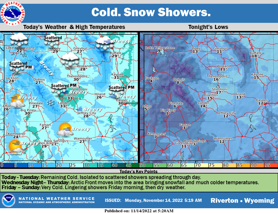
Weather Story
Another chilly day with a mix of clouds and sunshine. A cold front will spread snow showers into northern Wyoming this afternoon. Any accumulation should remain light. There will be a better chance of snow showers Monday afternoon and night.
– Detailed Forecast –
Today
Cold today with snow showers moving in from the north and spreading mainly across areas east of the Divide. Clearing a bit on Tuesday, with an Arctic Front moving into the state Wednesday evening bringing more widespread snow and very cold temperatures.
Tonight
A 30 percent chance of snow, mainly before midnight. Mostly cloudy, with a low around 11. Wind chill values as low as -5. South southwest wind 9 to 13 mph becoming east in the evening.
Tuesday
Mostly cloudy, then gradually becoming sunny, with a high near 27. Wind chill values as low as zero. West wind 8 to 13 mph.
Tuesday Night
Partly cloudy, with a low around 9. Wind chill values as low as zero. West southwest wind around 8 mph.
Wednesday
Sunny, with a high near 31. West southwest wind 7 to 11 mph.
Wednesday Night
Partly cloudy, with a low around 14. West wind around 13 mph.
Thursday
Partly sunny, with a high near 27. West wind 9 to 11 mph becoming east northeast in the afternoon.
Thursday Night
Mostly cloudy, with a low around 7.
Friday
Mostly sunny, with a high near 22.
Friday Night
Mostly clear, with a low around 4.
Saturday
Sunny, with a high near 30.
Saturday Night
Mostly clear, with a low around 9.
Sunday
Mostly sunny, with a high near 35.
Whatever the weather, have a wonderful day!
From all of us here at SweetwaterNOW

