
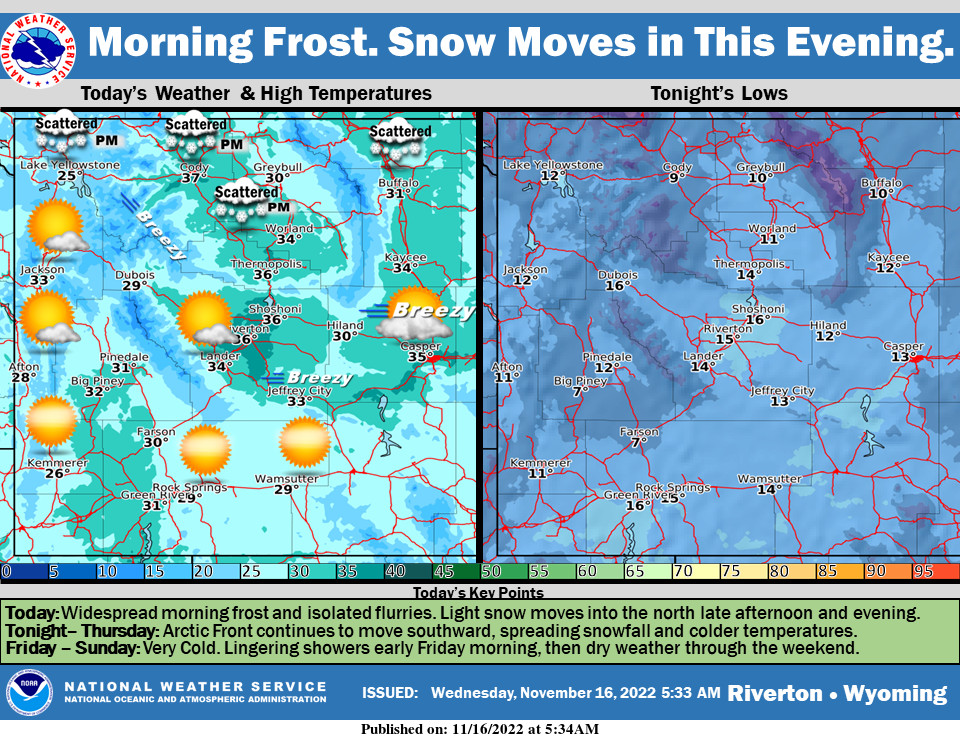
Weather Story
Widespread frost this morning and isolated flurries, will give way to a partly cloudy and chilly day. The Arctic Front will move in late afternoon, bringing more widespread snow and leaving frigid temperatures in its wake.
– Detailed Forecast –
Today
Mostly sunny, with a high near 29. Wind chill values as low as zero. Southwest wind 8 to 13 mph.
Tonight
Partly cloudy, with a low around 15. Breezy, with a west southwest wind 14 to 16 mph, with gusts as high as 23 mph.
Thursday
A 40 percent chance of snow, mainly after 8am. Mostly cloudy, with a high near 22. Wind chill values as low as -5. Blustery, with a west wind 8 to 16 mph becoming east northeast in the afternoon. Winds could gust as high as 23 mph. New snow accumulation of less than a half inch possible.
Thursday Night
A 40 percent chance of snow, mainly before 11pm. Mostly cloudy, with a low around 0. Wind chill values as low as -15. Breezy, with an east northeast wind 13 to 16 mph, with gusts as high as 21 mph. New snow accumulation of less than one inch possible.
Friday
Sunny, with a high near 18. East wind 6 to 11 mph becoming west in the afternoon.
Friday Night
Mostly clear, with a low around 0. Southwest wind around 7 mph.
Saturday
Sunny, with a high near 27. West southwest wind 6 to 10 mph.
Saturday Night
Mostly clear, with a low around 6.
Sunday
Sunny, with a high near 33.
Sunday Night
Mostly clear, with a low around 9.
Monday
Mostly sunny, with a high near 36.
Monday Night
Partly cloudy, with a low around 11.
Tuesday
Mostly sunny, with a high near 37.
Whatever the weather, have a wonderful day!
From all of us here at SweetwaterNOW

