
Weather Story
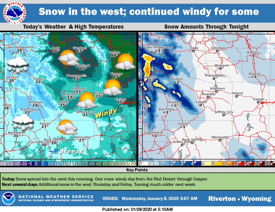
Snow will spread into the west today with light to moderate accumulations likely. There will be on more day from Jeffrey City through Casper today before the wind decreases tomorrow. Light snow possible in the north tonight. Additional snow is possible in the west Thursday and over the weekend. Turning much colder early next week.
– Detailed Forecast –
Today
Mostly cloudy, with a high near 31. Wind chill values as low as zero. Breezy, with a south wind 7 to 15 mph becoming west in the afternoon. Winds could gust as high as 21 mph.
Tonight
Mostly cloudy, with a low around 16. West wind 10 to 14 mph, with gusts as high as 20 mph.
Thursday
Cloudy, then becoming mostly sunny during the afternoon, with a high near 26. Breezy, with a west southwest wind 11 to 15 mph, with gusts as high as 21 mph.
Thursday Night
Mostly cloudy, with a low around 3. Wind chill values as low as -10. West wind 8 to 10 mph.
Friday
Mostly sunny, with a high near 19. West wind 9 to 13 mph, with gusts as high as 21 mph.
Friday Night
Partly cloudy, with a low around 3. West southwest wind 7 to 10 mph becoming south after midnight.
Saturday
Snow likely, mainly before 11am. Mostly cloudy, with a high near 23. Southwest wind 6 to 11 mph. Chance of precipitation is 60%.
Saturday Night
Mostly cloudy, with a low around 6.
Sunday
A 20 percent chance of snow. Partly sunny, with a high near 22.
Sunday Night
Mostly cloudy, with a low around 5.
Monday
Mostly cloudy, with a high near 22.
Monday Night
A slight chance of snow. Mostly cloudy, with a low around 9.
Tuesday
A chance of snow. Mostly cloudy, with a high near 22. Breezy.
Whatever the weather, have a wonderful day!
From all of us here at SweetwaterNOW

