
Weather Story
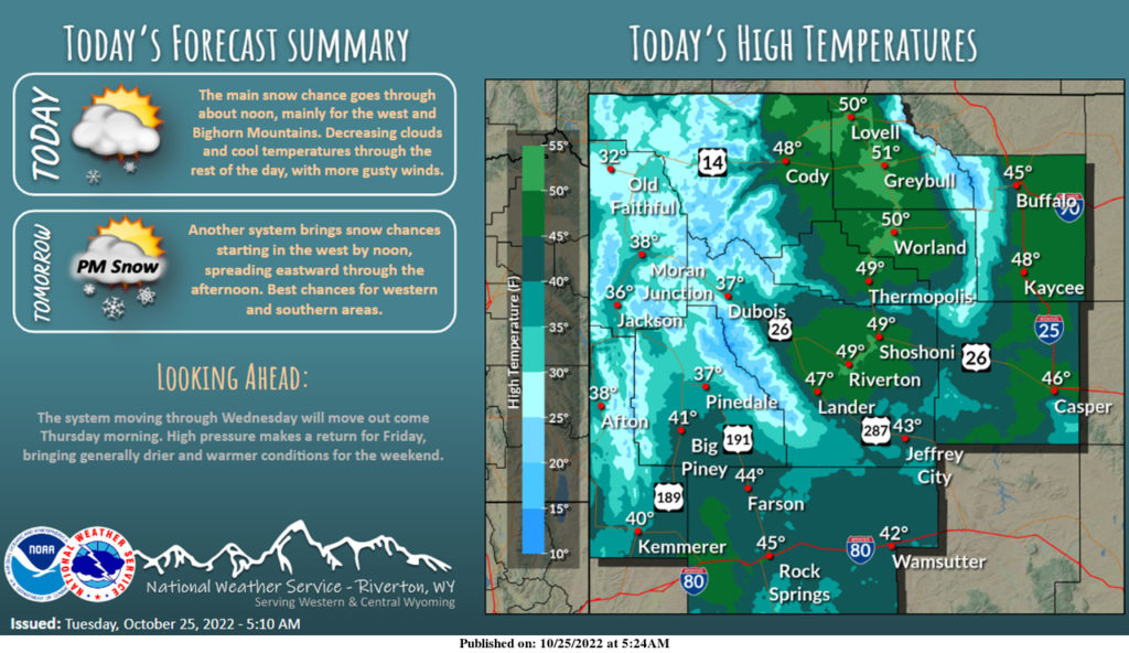
Snow over western Wyoming should end by around noon. Elsewhere may see some light snow through the rest of the day, with the potential of light rain or ice pellets for eastern areas this afternoon. Otherwise, breezy to windy, with a clearing sky through the day.
– Detailed Forecast –
Today
A 40 percent chance of snow, mainly before noon. Cloudy, then gradually becoming mostly sunny, with a high near 44. Breezy, with a west southwest wind 11 to 16 mph increasing to 19 to 24 mph in the afternoon. Winds could gust as high as 37 mph. Total daytime snow accumulation of less than a half inch possible.
Tonight
Partly cloudy, with a low around 21. Breezy, with a west wind 18 to 23 mph becoming light and variable after midnight. Winds could gust as high as 34 mph.
Wednesday
A slight chance of snow between noon and 1pm, then a chance of rain and snow. Partly sunny, with a high near 45. Breezy, with a light and variable wind becoming west 15 to 20 mph in the morning. Winds could gust as high as 30 mph. Chance of precipitation is 30%.
Wednesday Night
A 30 percent chance of snow, mainly before midnight. Mostly cloudy, with a low around 20. Breezy, with a west wind 13 to 20 mph, with gusts as high as 30 mph.
Thursday
Sunny, with a high near 39. West wind 11 to 14 mph, with gusts as high as 21 mph.
Thursday Night
Mostly clear, with a low around 18. Southwest wind 6 to 14 mph, with gusts as high as 20 mph.
Friday
Mostly sunny, with a high near 45. South southwest wind 5 to 7 mph.
Friday Night
Mostly cloudy, with a low around 22.
Saturday
Mostly sunny, with a high near 50.
Saturday Night
Partly cloudy, with a low around 25.
Sunday
Partly sunny, with a high near 51.
Sunday Night
Partly cloudy, with a low around 28.
Monday
Partly sunny, with a high near 49. Breezy.
Whatever the weather, have a wonderful day!
From all of us here at SweetwaterNOW