
Weather Story
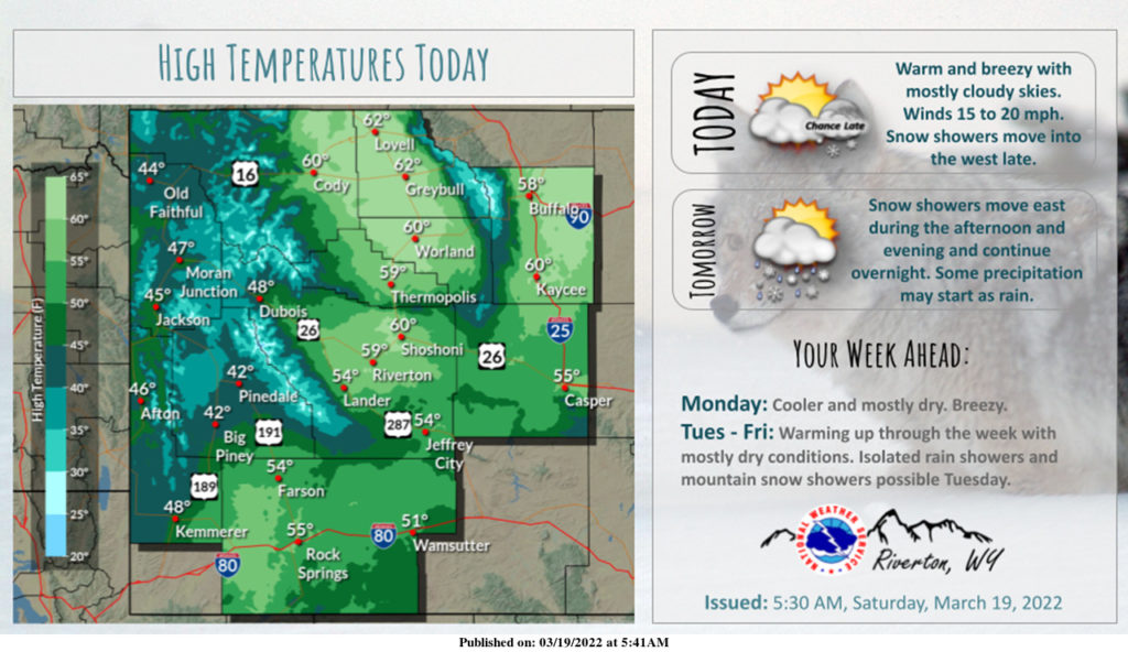
Above normal temperatures and mostly dry today. Our next winter storm moves in late tonight, and will impact the region through Sunday night. Accumulating snowfall is expected across much of the region Sunday and Sunday night.
– Detailed Forecast –
Today
Mostly sunny, with a high near 54. Breezy, with a southeast wind 8 to 13 mph becoming south southwest 16 to 21 mph in the afternoon.
Tonight
Mostly cloudy, with a low around 34. Breezy, with a south wind 17 to 22 mph decreasing to 9 to 14 mph after midnight. Winds could gust as high as 28 mph.
Sunday
Rain and snow showers likely, becoming all snow after 4pm. Mostly cloudy, with a high near 48. Windy, with a south wind 9 to 14 mph becoming west 20 to 25 mph in the afternoon. Winds could gust as high as 36 mph. Chance of precipitation is 70%. New snow accumulation of less than a half inch possible.
Sunday Night
Scattered snow showers, mainly before midnight. Mostly cloudy, with a low around 22. Windy, with a northwest wind 20 to 25 mph decreasing to 14 to 19 mph after midnight. Winds could gust as high as 34 mph. Chance of precipitation is 50%. New snow accumulation of less than a half inch possible.
Monday
Mostly sunny, with a high near 39. Breezy, with a northwest wind 11 to 18 mph, with gusts as high as 28 mph.
Monday Night
Mostly clear, with a low around 21. Blustery, with a west wind 10 to 16 mph, with gusts as high as 23 mph
Tuesday
Mostly sunny, with a high near 43. Breezy, with a west wind 10 to 16 mph becoming north in the afternoon. Winds could gust as high as 24 mph.
Tuesday Night
Partly cloudy, with a low around 22. Blustery.
Wednesday
Sunny, with a high near 49. Breezy.
Wednesday Night
Mostly clear, with a low around 25. Blustery.
Thursday
Sunny, with a high near 57. Breezy.
Thursday Night
Mostly clear, with a low around 30. Breezy.
Friday
Sunny, with a high near 61. Breezy.
Whatever the weather, have a wonderful day!
From all of us here at SweetwaterNOW