
Weather Story
Most areas begin drying out today, but showers develop this afternoon across northwest WY. Temperatures will be warmer today and back into the 70s by Friday.
– Detailed Forecast –
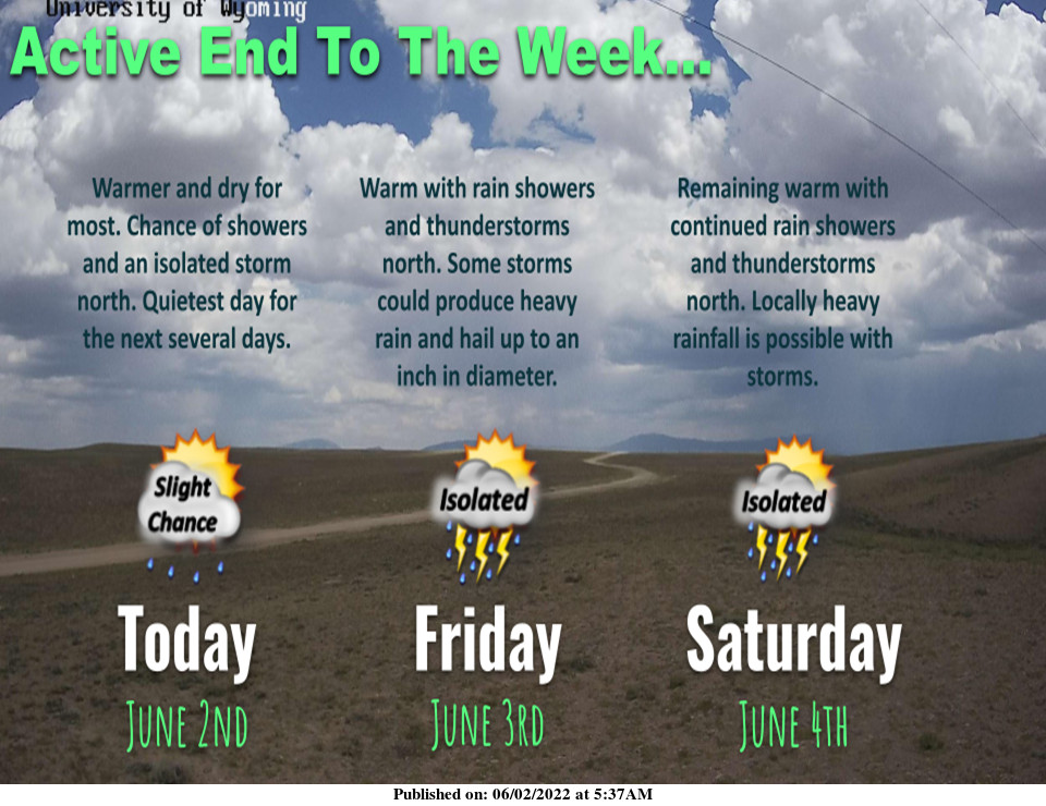
Today
Mostly sunny, with a high near 72. East wind 5 to 9 mph becoming west in the afternoon.
Tonight
Partly cloudy, with a low around 44. West wind 5 to 9 mph becoming light and variable.
Friday
Scattered showers after 3pm. Partly sunny, with a high near 75. East wind 6 to 14 mph becoming west southwest in the afternoon. Winds could gust as high as 22 mph. Chance of precipitation is 30%.
Friday Night
Partly cloudy, with a low around 47. Breezy, with a southwest wind 10 to 15 mph becoming light after midnight. Winds could gust as high as 23 mph.
Saturday
Partly sunny, with a high near 74. Breezy, with a light southwest wind becoming west 11 to 16 mph in the morning. Winds could gust as high as 24 mph.
Saturday Night
Mostly cloudy, with a low around 50. Breezy, with a west wind 9 to 15 mph, with gusts as high as 23 mph.
Sunday
Partly sunny, with a high near 70. Breezy, with a west wind 9 to 14 mph increasing to 17 to 22 mph in the afternoon. Winds could gust as high as 33 mph.
Sunday Night
Partly cloudy, with a low around 46. Breezy.
Monday
A 20 percent chance of showers and thunderstorms after noon. Some of the storms could produce small hail and heavy rain. Mostly sunny, with a high near 69. Breezy.
Monday Night
Partly cloudy, with a low around 43. Breezy.
Tuesday
A slight chance of showers and thunderstorms. Some of the storms could produce small hail and heavy rain. Mostly sunny, with a high near 69. Breezy.
Tuesday Night
Mostly clear, with a low around 39. Breezy.
Wednesday
Mostly sunny, with a high near 70.
Whatever the weather, have a wonderful day!
From all of us here at SweetwaterNOW

