
Weather Story
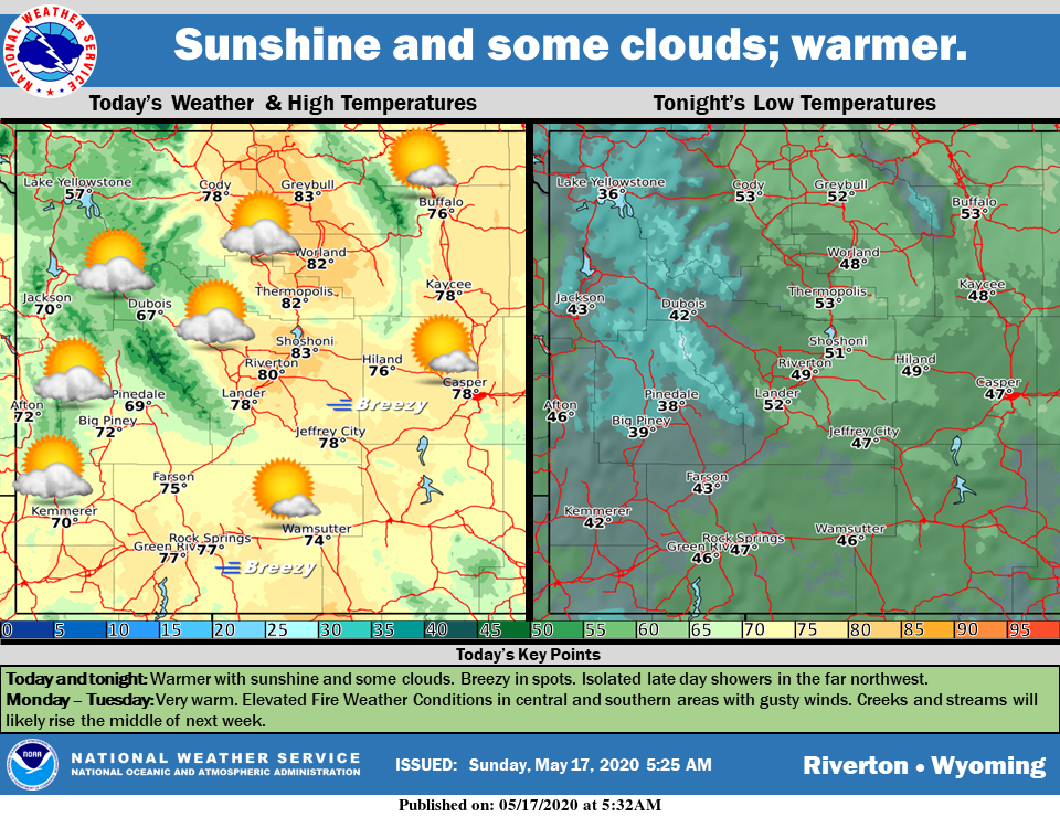
Warmer today with a mix of clouds and sunshine. Locally breezy in southern Wyoming. Isolated late day showers are possible in the far northwest. A combination of warm temperatures and breezy to windy conditions will bring elevated fire behavior and rising stream and river levels into early next week.
– Detailed Forecast –
Today
Mostly sunny, with a high near 77. Light and variable wind becoming south southwest 9 to 14 mph in the afternoon. Winds could gust as high as 20 mph.
Tonight
Mostly clear, with a low around 48. South wind 6 to 13 mph.
Monday
Sunny, with a high near 81. Breezy, with a south southwest wind 6 to 11 mph increasing to 17 to 22 mph in the afternoon. Winds could gust as high as 31 mph.
Monday Night
Mostly clear, with a low around 50. Breezy, with a south wind 15 to 20 mph decreasing to 9 to 14 mph after midnight. Winds could gust as high as 28 mph.
Tuesday
Sunny, with a high near 77. Breezy, with a south wind 10 to 15 mph increasing to 18 to 23 mph in the afternoon. Winds could gust as high as 32 mph.
Tuesday Night
Partly cloudy, with a low around 46. Breezy, with a south wind 17 to 22 mph decreasing to 6 to 11 mph after midnight. Winds could gust as high as 31 mph.
Wednesday
A 30 percent chance of showers after noon. Mostly sunny, with a high near 60. Breezy, with a southwest wind 8 to 13 mph increasing to 15 to 20 mph in the afternoon. Winds could gust as high as 32 mph.
Wednesday Night
Mostly cloudy, with a low around 35. Breezy.
Thursday
Mostly sunny, with a high near 61. Breezy.
Thursday Night
Mostly clear, with a low around 37.
Friday
Mostly sunny, with a high near 68. Breezy.
Friday Night
Mostly cloudy, with a low around 38.
Saturday
Partly sunny, with a high near 61.
Whatever the weather, have a wonderful day!
From all of us here at SweetwaterNOW

