
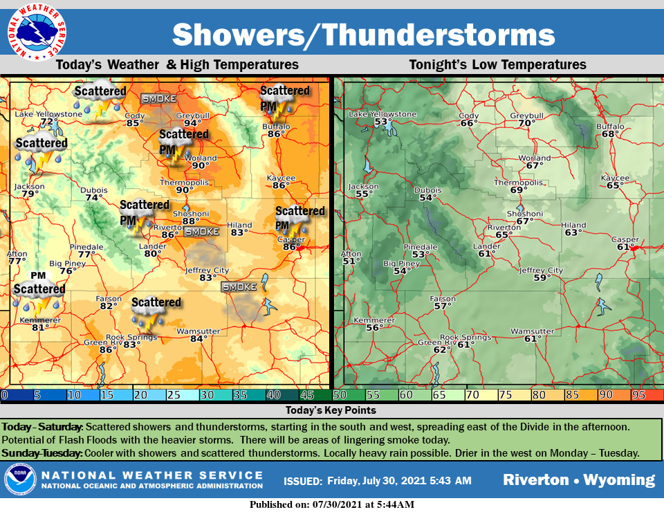
Weather Story
A few morning showers will give way to isolated showers and thunderstorms during the afternoon and evening. The thunderstorms will be most common over the Absaroka and Wind River ranges. Temperatures will be on the rise through the weekend as high pressure takes hold. It will be dry and hot by Sunday with daytime highs much above normal.
– Detailed Forecast –
Today
Isolated showers and thunderstorms after 3pm. Some of the storms could produce gusty winds. Areas of smoke. Mostly sunny, with a high near 85. West southwest wind 7 to 11 mph. Chance of precipitation is 20%
Tonight
Isolated showers and thunderstorms before 9pm. Some of the storms could produce gusty winds. Partly cloudy, with a low around 55. Southwest wind 5 to 13 mph, with gusts as high as 20 mph. Chance of precipitation is 20%.
Saturday
Mostly sunny, with a high near 87. Light southwest wind becoming west 5 to 10 mph in the morning.
Saturday Night
Mostly clear, with a low around 60. West southwest wind 6 to 11 mph becoming light and variable after midnight.
Sunday
Sunny, with a high near 93. Calm wind becoming northeast around 6 mph in the afternoon.
Sunday Night
Mostly clear, with a low around 62. East wind 6 to 8 mph.
Monday
Sunny, with a high near 94. East southeast wind 8 to 11 mph.
Monday Night
Partly cloudy, with a low around 61.
Tuesday
A 20 percent chance of showers and thunderstorms after noon. Some of the storms could produce gusty winds. Mostly sunny, with a high near 93.
Tuesday Night
Partly cloudy, with a low around 62. Breezy.
Wednesday
Mostly sunny, with a high near 92.
Wednesday Night
A chance of showers and thunderstorms. Some of the storms could produce gusty winds. Mostly cloudy, with a low around 62.
Thursday
Mostly sunny, with a high near 91.
Whatever the weather, have a wonderful day!
From all of us here at SweetwaterNOW

