
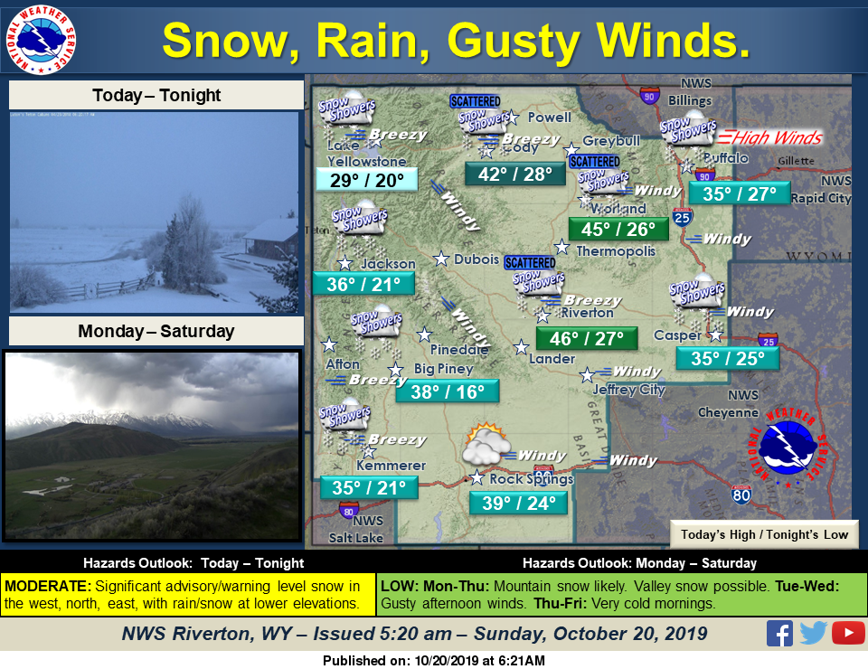
A cold front will bring significant mountain snow and valley rain/snow today, mainly across the west, north and east. A Winter Storm Warning and Winter Weather Advisories are in effect. High winds are also possible in northeast Johnson County.
Detailed Forecast
Today
Partly sunny, with a high near 39. Windy, with a west wind 25 to 28 mph, with gusts as high as 41 mph.
Tonight
Scattered snow showers, mainly after midnight. Increasing clouds, with a low around 25. Breezy, with a west wind 15 to 24 mph, with gusts as high as 33 mph. Chance of precipitation is 30%.
Monday
Scattered snow showers, mainly before 10am. Partly sunny, with a high near 43. Breezy, with a west wind 14 to 20 mph, with gusts as high as 32 mph. Chance of precipitation is 30%.
Monday Night
Partly cloudy, with a low around 29. Breezy, with a west wind 13 to 20 mph, with gusts as high as 31 mph.
Tuesday
Partly sunny, with a high near 52. Breezy, with a west wind 14 to 22 mph, with gusts as high as 36 mph.
Tuesday Night
A slight chance of rain showers after 1am, mixing with snow after 3am. Partly cloudy, with a low around 32. Breezy, with a west wind 15 to 22 mph, with gusts as high as 34 mph. Chance of precipitation is 20%.
Wednesday
A slight chance of rain and snow showers before 1pm, then a chance of snow showers between 1pm and 4pm, then a chance of rain showers after 4pm. Mostly sunny, with a high near 46. Breezy, with a west wind 11 to 16 mph, with gusts as high as 29 mph. Chance of precipitation is 30%.
Wednesday Night
A 30 percent chance of snow showers, mainly before 7pm. Mostly cloudy, with a low around 20.
Thursday
Mostly sunny, with a high near 41.
Thursday Night
Mostly clear, with a low around 20.
Friday
Sunny, with a high near 53.
Advertisement - Story continues below...
Friday Night
Mostly clear, with a low around 29.
Saturday
Sunny, with a high near 50. Breezy.

