
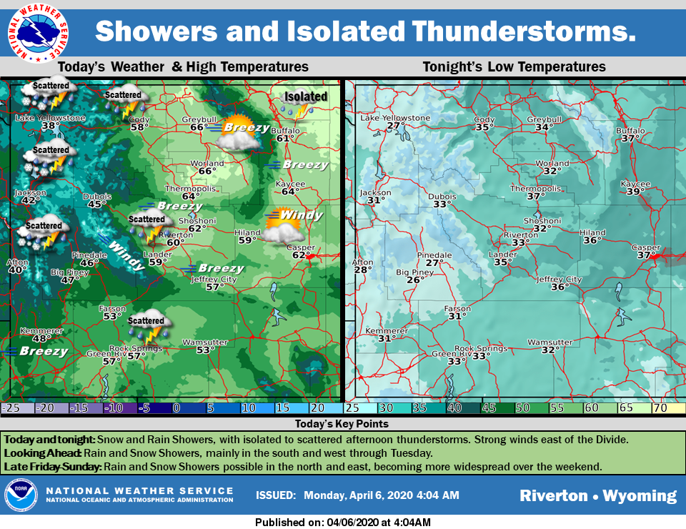
Weather Story
Snow and Rain Showers across the west and south. Isolated to scattered afternoon and evening Thunderstorms. Showers will last through Tuesday. Strong winds east of the Divide and along the mountains on Monday. Mid week will see a break in the showers.
– Detailed Forecast –
Today
Scattered showers and thunderstorms, mainly after 3pm. Partly sunny, with a high near 56. Breezy, with a south wind 6 to 11 mph becoming west southwest 17 to 22 mph in the afternoon. Winds could gust as high as 31 mph. Chance of precipitation is 50%.
Tonight
A chance of showers and thunderstorms before 10pm, then a slight chance of showers between 10pm and midnight. Mostly cloudy, with a low around 33. Breezy, with a west southwest wind 8 to 18 mph, with gusts as high as 25 mph. Chance of precipitation is 40%.
Tuesday
Mostly sunny, with a high near 55. Breezy, with a west wind 8 to 15 mph, with gusts as high as 22 mph.
Tuesday Night
Partly cloudy, with a low around 31. Breezy, with a west southwest wind 7 to 15 mph, with gusts as high as 21 mph.
Wednesday
Sunny, with a high near 60. West southwest wind 7 to 13 mph becoming north northwest in the afternoon.
Wednesday Night
Mostly clear, with a low around 31. North wind 9 to 13 mph becoming east northeast after midnight.
Thursday
Sunny, with a high near 58. East northeast wind 9 to 13 mph, with gusts as high as 23 mph.
Thursday Night
Mostly clear, with a low around 34.
Friday
Mostly sunny, with a high near 59. Breezy.
Friday Night
Partly cloudy, with a low around 34. Breezy.
Saturday
A slight chance of rain. Mostly sunny, with a high near 57. Breezy.
Saturday Night
A slight chance of rain and snow. Mostly cloudy, with a low around 30. Blustery.
Sunday
A chance of rain and snow. Partly sunny, with a high near 50.
Whatever the weather, have a wonderful day!
From all of us here at SweetwaterNOW

